You are here: Home > Network List > TA - USArray Transportable Network (new EarthScope stations) Stations List
> Station R26A Arlington, CO, USA > Earthquake Result Viewer
R26A Arlington, CO, USA - Earthquake Result Viewer
*The percent match for this event was below the threshold and hence no stack was calculated.
| Earthquake location: |
Northern Chile |
| Earthquake latitude/longitude: |
-22.2/-68.3 |
| Earthquake time(UTC): |
2010/03/04 (063) 22:39:26 GMT |
| Earthquake Depth: |
114 km |
| Earthquake Magnitude: |
6.3 MB, 6.4 MW, 6.3 MW |
| Earthquake Catalog/Contributor: |
WHDF/NEIC |
|
| Network: |
TA USArray Transportable Network (new EarthScope stations) |
| Station: |
R26A Arlington, CO, USA |
| Lat/Lon: |
38.30 N/103.45 W |
| Elevation: |
1304 m |
|
| Distance: |
68.6 deg |
| Az: |
330.923 deg |
| Baz: |
145.087 deg |
| Ray Param: |
$rayparam |
*The percent match for this event was below the threshold and hence was not used in the summary stack. |
|
| Radial Match: |
79.882095 % |
| Radial Bump: |
309 |
| Transverse Match: |
68.29852 % |
| Transverse Bump: |
400 |
| SOD ConfigId: |
308276 |
| Insert Time: |
2010-06-22 16:55:28.569 +0000 |
| GWidth: |
2.5 |
| Max Bumps: |
400 |
| Tol: |
0.001 |
|
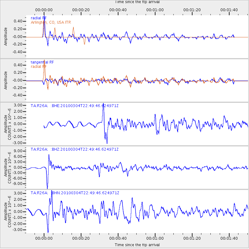
Signal To Noise
| Channel | StoN | STA | LTA |
| TA:R26A: :BHZ:20100304T22:49:46.624971Z | 11.2412195 | 4.1444746E-6 | 3.6868548E-7 |
| TA:R26A: :BHN:20100304T22:49:46.624971Z | 3.7968144 | 1.6017817E-6 | 4.2187517E-7 |
| TA:R26A: :BHE:20100304T22:49:46.624971Z | 5.2758145 | 1.5334715E-6 | 2.906606E-7 |
| Arrivals |
| Ps | |
| PpPs | |
| PsPs/PpSs | |


