You are here: Home > Network List > TA - USArray Transportable Network (new EarthScope stations) Stations List
> Station S26A Kim, CO, USA > Earthquake Result Viewer
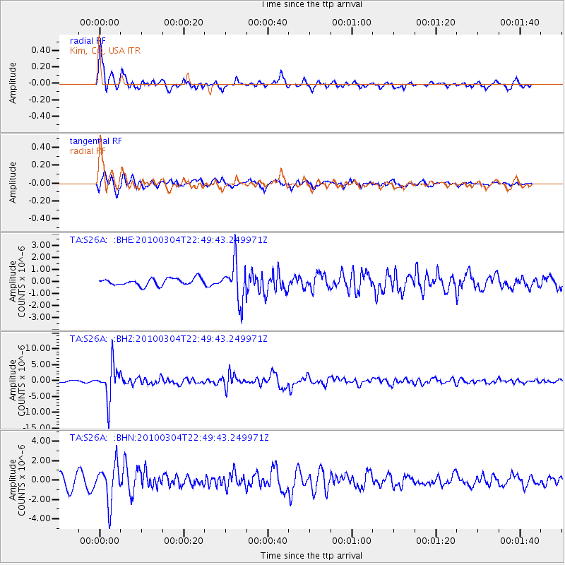
S26A Kim, CO, USA - Earthquake Result Viewer
*The percent match for this event was below the threshold and hence no stack was calculated.
| Earthquake location: |
Northern Chile |
| Earthquake latitude/longitude: |
-22.2/-68.3 |
| Earthquake time(UTC): |
2010/03/04 (063) 22:39:26 GMT |
| Earthquake Depth: |
114 km |
| Earthquake Magnitude: |
6.3 MB, 6.4 MW, 6.3 MW |
| Earthquake Catalog/Contributor: |
WHDF/NEIC |
|
| Network: |
TA USArray Transportable Network (new EarthScope stations) |
| Station: |
S26A Kim, CO, USA |
| Lat/Lon: |
37.62 N/103.47 W |
| Elevation: |
1394 m |
|
| Distance: |
68.1 deg |
| Az: |
330.487 deg |
| Baz: |
144.911 deg |
| Ray Param: |
$rayparam |
*The percent match for this event was below the threshold and hence was not used in the summary stack. |
|
| Radial Match: |
78.26527 % |
| Radial Bump: |
347 |
| Transverse Match: |
74.93966 % |
| Transverse Bump: |
396 |
| SOD ConfigId: |
308276 |
| Insert Time: |
2010-06-22 16:55:58.573 +0000 |
| GWidth: |
2.5 |
| Max Bumps: |
400 |
| Tol: |
0.001 |
|
Signal To Noise
| Channel | StoN | STA | LTA |
| TA:S26A: :BHZ:20100304T22:49:43.249971Z | 25.763914 | 5.6749536E-6 | 2.2026754E-7 |
| TA:S26A: :BHN:20100304T22:49:43.249971Z | 2.8420618 | 1.9702425E-6 | 6.932441E-7 |
| TA:S26A: :BHE:20100304T22:49:43.249971Z | 5.715669 | 1.6424646E-6 | 2.8736173E-7 |
| Arrivals |
| Ps | |
| PpPs | |
| PsPs/PpSs | |


