You are here: Home > Network List > US - United States National Seismic Network Stations List
> Station DGMT Dagmar, Montana, USA > Earthquake Result Viewer
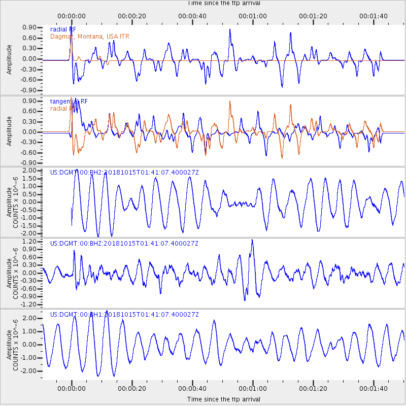
DGMT Dagmar, Montana, USA - Earthquake Result Viewer
*The percent match for this event was below the threshold and hence no stack was calculated.
| Earthquake location: |
Near East Coast Of Kamchatka |
| Earthquake latitude/longitude: |
54.1/159.5 |
| Earthquake time(UTC): |
2018/10/15 (288) 01:32:12 GMT |
| Earthquake Depth: |
124 km |
| Earthquake Magnitude: |
5.6 mb |
| Earthquake Catalog/Contributor: |
NEIC PDE/us |
|
| Network: |
US United States National Seismic Network |
| Station: |
DGMT Dagmar, Montana, USA |
| Lat/Lon: |
48.47 N/104.20 W |
| Elevation: |
0.0 m |
|
| Distance: |
56.0 deg |
| Az: |
52.948 deg |
| Baz: |
315.018 deg |
| Ray Param: |
$rayparam |
*The percent match for this event was below the threshold and hence was not used in the summary stack. |
|
| Radial Match: |
33.578114 % |
| Radial Bump: |
345 |
| Transverse Match: |
53.68745 % |
| Transverse Bump: |
400 |
| SOD ConfigId: |
3045211 |
| Insert Time: |
2018-10-29 01:42:18.729 +0000 |
| GWidth: |
2.5 |
| Max Bumps: |
400 |
| Tol: |
0.001 |
|
Signal To Noise
| Channel | StoN | STA | LTA |
| US:DGMT:00:BHZ:20181015T01:41:07.400027Z | 1.7505786 | 3.8271662E-7 | 2.1862293E-7 |
| US:DGMT:00:BH1:20181015T01:41:07.400027Z | 1.8790699 | 1.424918E-6 | 7.583102E-7 |
| US:DGMT:00:BH2:20181015T01:41:07.400027Z | 0.9246957 | 1.0386992E-6 | 1.1232877E-6 |
| Arrivals |
| Ps | |
| PpPs | |
| PsPs/PpSs | |


