You are here: Home > Network List > US - United States National Seismic Network Stations List
> Station MSO Missoula, Montana, USA > Earthquake Result Viewer
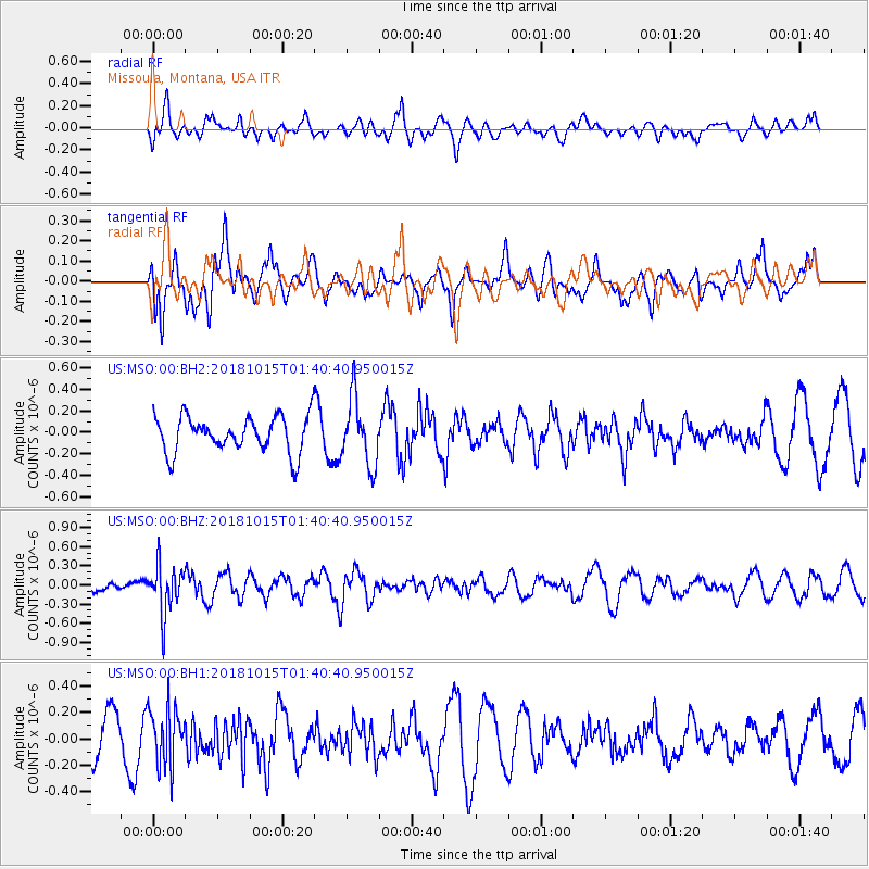
MSO Missoula, Montana, USA - Earthquake Result Viewer
*The percent match for this event was below the threshold and hence no stack was calculated.
| Earthquake location: |
Near East Coast Of Kamchatka |
| Earthquake latitude/longitude: |
54.1/159.5 |
| Earthquake time(UTC): |
2018/10/15 (288) 01:32:12 GMT |
| Earthquake Depth: |
124 km |
| Earthquake Magnitude: |
5.6 mb |
| Earthquake Catalog/Contributor: |
NEIC PDE/us |
|
| Network: |
US United States National Seismic Network |
| Station: |
MSO Missoula, Montana, USA |
| Lat/Lon: |
46.83 N/113.94 W |
| Elevation: |
1264 m |
|
| Distance: |
52.3 deg |
| Az: |
60.005 deg |
| Baz: |
311.969 deg |
| Ray Param: |
$rayparam |
*The percent match for this event was below the threshold and hence was not used in the summary stack. |
|
| Radial Match: |
53.506294 % |
| Radial Bump: |
400 |
| Transverse Match: |
59.084766 % |
| Transverse Bump: |
400 |
| SOD ConfigId: |
3045211 |
| Insert Time: |
2018-10-29 01:42:47.345 +0000 |
| GWidth: |
2.5 |
| Max Bumps: |
400 |
| Tol: |
0.001 |
|
Signal To Noise
| Channel | StoN | STA | LTA |
| US:MSO:00:BHZ:20181015T01:40:40.950015Z | 2.5440302 | 3.7832734E-7 | 1.487118E-7 |
| US:MSO:00:BH1:20181015T01:40:40.950015Z | 1.4730256 | 2.1777639E-7 | 1.4784291E-7 |
| US:MSO:00:BH2:20181015T01:40:40.950015Z | 1.8390406 | 3.0932753E-7 | 1.682005E-7 |
| Arrivals |
| Ps | |
| PpPs | |
| PsPs/PpSs | |


