You are here: Home > Network List > US - United States National Seismic Network Stations List
> Station WUAZ Wupatki, Arizona, USA > Earthquake Result Viewer
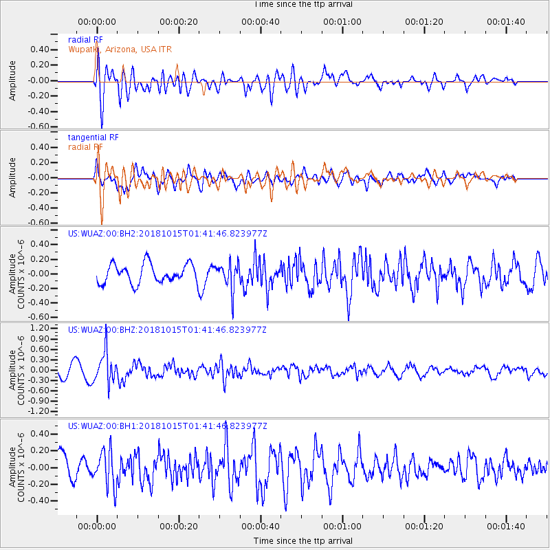
WUAZ Wupatki, Arizona, USA - Earthquake Result Viewer
*The percent match for this event was below the threshold and hence no stack was calculated.
| Earthquake location: |
Near East Coast Of Kamchatka |
| Earthquake latitude/longitude: |
54.1/159.5 |
| Earthquake time(UTC): |
2018/10/15 (288) 01:32:12 GMT |
| Earthquake Depth: |
124 km |
| Earthquake Magnitude: |
5.6 mb |
| Earthquake Catalog/Contributor: |
NEIC PDE/us |
|
| Network: |
US United States National Seismic Network |
| Station: |
WUAZ Wupatki, Arizona, USA |
| Lat/Lon: |
35.52 N/111.37 W |
| Elevation: |
1592 m |
|
| Distance: |
61.7 deg |
| Az: |
67.894 deg |
| Baz: |
317.976 deg |
| Ray Param: |
$rayparam |
*The percent match for this event was below the threshold and hence was not used in the summary stack. |
|
| Radial Match: |
63.945457 % |
| Radial Bump: |
400 |
| Transverse Match: |
69.05201 % |
| Transverse Bump: |
400 |
| SOD ConfigId: |
3045211 |
| Insert Time: |
2018-10-29 01:43:06.458 +0000 |
| GWidth: |
2.5 |
| Max Bumps: |
400 |
| Tol: |
0.001 |
|
Signal To Noise
| Channel | StoN | STA | LTA |
| US:WUAZ:00:BHZ:20181015T01:41:46.823977Z | 2.4073951 | 4.593241E-7 | 1.9079714E-7 |
| US:WUAZ:00:BH1:20181015T01:41:46.823977Z | 1.4559292 | 2.1831124E-7 | 1.4994635E-7 |
| US:WUAZ:00:BH2:20181015T01:41:46.823977Z | 1.3974462 | 1.8319483E-7 | 1.3109259E-7 |
| Arrivals |
| Ps | |
| PpPs | |
| PsPs/PpSs | |


