You are here: Home > Network List > UU - University of Utah Regional Network Stations List
> Station CCUT Cedar City, UT, USA > Earthquake Result Viewer
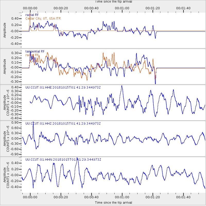
CCUT Cedar City, UT, USA - Earthquake Result Viewer
*The percent match for this event was below the threshold and hence no stack was calculated.
| Earthquake location: |
Near East Coast Of Kamchatka |
| Earthquake latitude/longitude: |
54.1/159.5 |
| Earthquake time(UTC): |
2018/10/15 (288) 01:32:12 GMT |
| Earthquake Depth: |
124 km |
| Earthquake Magnitude: |
5.6 mb |
| Earthquake Catalog/Contributor: |
NEIC PDE/us |
|
| Network: |
UU University of Utah Regional Network |
| Station: |
CCUT Cedar City, UT, USA |
| Lat/Lon: |
37.55 N/113.36 W |
| Elevation: |
2127 m |
|
| Distance: |
59.1 deg |
| Az: |
67.667 deg |
| Baz: |
316.684 deg |
| Ray Param: |
$rayparam |
*The percent match for this event was below the threshold and hence was not used in the summary stack. |
|
| Radial Match: |
51.579784 % |
| Radial Bump: |
400 |
| Transverse Match: |
60.624905 % |
| Transverse Bump: |
400 |
| SOD ConfigId: |
3045211 |
| Insert Time: |
2018-10-29 01:43:16.552 +0000 |
| GWidth: |
2.5 |
| Max Bumps: |
400 |
| Tol: |
0.001 |
|
Signal To Noise
| Channel | StoN | STA | LTA |
| UU:CCUT:01:HHZ:20181015T01:41:29.344973Z | 3.252378 | 3.6132005E-7 | 1.1109411E-7 |
| UU:CCUT:01:HHN:20181015T01:41:29.344973Z | 2.0855982 | 2.0943644E-7 | 1.0042032E-7 |
| UU:CCUT:01:HHE:20181015T01:41:29.344973Z | 1.5020568 | 1.1727854E-7 | 7.807863E-8 |
| Arrivals |
| Ps | |
| PpPs | |
| PsPs/PpSs | |


