You are here: Home > Network List > TA - USArray Transportable Network (new EarthScope stations) Stations List
> Station S28A Manter, KS, USA > Earthquake Result Viewer
S28A Manter, KS, USA - Earthquake Result Viewer
*The percent match for this event was below the threshold and hence no stack was calculated.
| Earthquake location: |
Northern Chile |
| Earthquake latitude/longitude: |
-22.2/-68.3 |
| Earthquake time(UTC): |
2010/03/04 (063) 22:39:26 GMT |
| Earthquake Depth: |
114 km |
| Earthquake Magnitude: |
6.3 MB, 6.4 MW, 6.3 MW |
| Earthquake Catalog/Contributor: |
WHDF/NEIC |
|
| Network: |
TA USArray Transportable Network (new EarthScope stations) |
| Station: |
S28A Manter, KS, USA |
| Lat/Lon: |
37.59 N/101.90 W |
| Elevation: |
1064 m |
|
| Distance: |
67.4 deg |
| Az: |
331.582 deg |
| Baz: |
146.282 deg |
| Ray Param: |
$rayparam |
*The percent match for this event was below the threshold and hence was not used in the summary stack. |
|
| Radial Match: |
57.19412 % |
| Radial Bump: |
316 |
| Transverse Match: |
73.01618 % |
| Transverse Bump: |
386 |
| SOD ConfigId: |
308276 |
| Insert Time: |
2010-06-22 17:02:11.080 +0000 |
| GWidth: |
2.5 |
| Max Bumps: |
400 |
| Tol: |
0.001 |
|
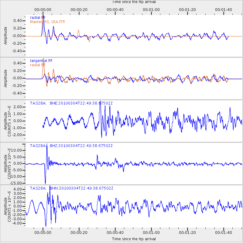
Signal To Noise
| Channel | StoN | STA | LTA |
| TA:S28A: :BHZ:20100304T22:49:38.67502Z | 15.347482 | 5.494631E-6 | 3.5801514E-7 |
| TA:S28A: :BHN:20100304T22:49:38.67502Z | 2.6351988 | 2.258289E-6 | 8.56971E-7 |
| TA:S28A: :BHE:20100304T22:49:38.67502Z | 3.025606 | 1.3369975E-6 | 4.4189412E-7 |
| Arrivals |
| Ps | |
| PpPs | |
| PsPs/PpSs | |


