You are here: Home > Network List > UU - University of Utah Regional Network Stations List
> Station KNB Kanab, UT, USA > Earthquake Result Viewer
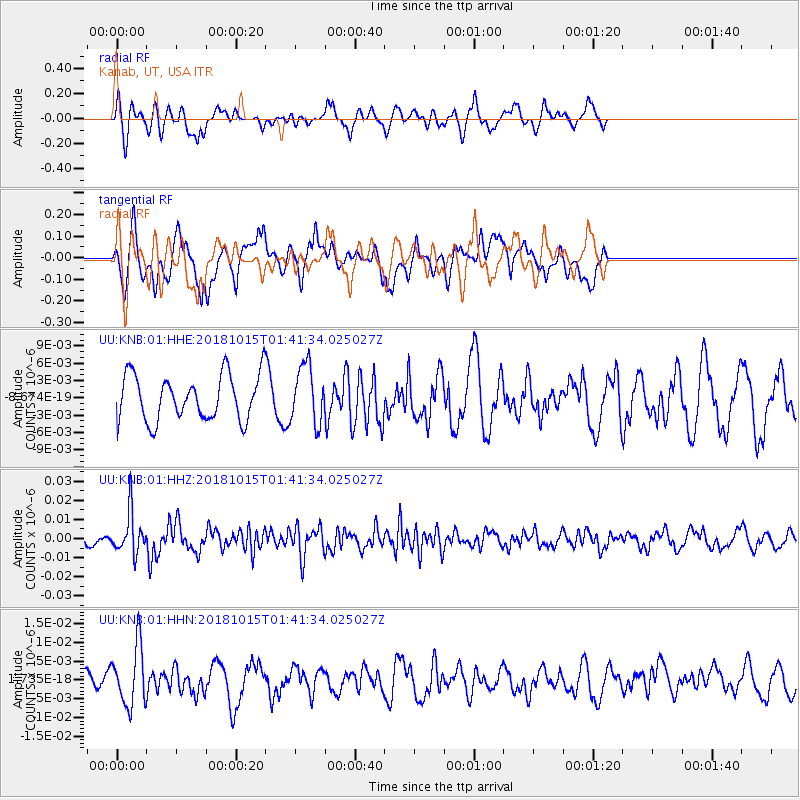
KNB Kanab, UT, USA - Earthquake Result Viewer
*The percent match for this event was below the threshold and hence no stack was calculated.
| Earthquake location: |
Near East Coast Of Kamchatka |
| Earthquake latitude/longitude: |
54.1/159.5 |
| Earthquake time(UTC): |
2018/10/15 (288) 01:32:12 GMT |
| Earthquake Depth: |
124 km |
| Earthquake Magnitude: |
5.6 mb |
| Earthquake Catalog/Contributor: |
NEIC PDE/us |
|
| Network: |
UU University of Utah Regional Network |
| Station: |
KNB Kanab, UT, USA |
| Lat/Lon: |
37.02 N/112.82 W |
| Elevation: |
1715 m |
|
| Distance: |
59.8 deg |
| Az: |
67.725 deg |
| Baz: |
317.04 deg |
| Ray Param: |
$rayparam |
*The percent match for this event was below the threshold and hence was not used in the summary stack. |
|
| Radial Match: |
52.824013 % |
| Radial Bump: |
338 |
| Transverse Match: |
53.914803 % |
| Transverse Bump: |
400 |
| SOD ConfigId: |
3045211 |
| Insert Time: |
2018-10-29 01:43:35.650 +0000 |
| GWidth: |
2.5 |
| Max Bumps: |
400 |
| Tol: |
0.001 |
|
Signal To Noise
| Channel | StoN | STA | LTA |
| UU:KNB:01:HHZ:20181015T01:41:34.025027Z | 3.1911397 | 1.0678702E-8 | 3.34636E-9 |
| UU:KNB:01:HHN:20181015T01:41:34.025027Z | 2.7549534 | 7.891228E-9 | 2.864378E-9 |
| UU:KNB:01:HHE:20181015T01:41:34.025027Z | 1.2850404 | 5.0361377E-9 | 3.91905E-9 |
| Arrivals |
| Ps | |
| PpPs | |
| PsPs/PpSs | |


