You are here: Home > Network List > US - United States National Seismic Network Stations List
> Station DGMT Dagmar, Montana, USA > Earthquake Result Viewer
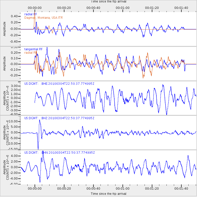
DGMT Dagmar, Montana, USA - Earthquake Result Viewer
*The percent match for this event was below the threshold and hence no stack was calculated.
| Earthquake location: |
Northern Chile |
| Earthquake latitude/longitude: |
-22.2/-68.3 |
| Earthquake time(UTC): |
2010/03/04 (063) 22:39:26 GMT |
| Earthquake Depth: |
114 km |
| Earthquake Magnitude: |
6.3 MB, 6.4 MW, 6.3 MW |
| Earthquake Catalog/Contributor: |
WHDF/NEIC |
|
| Network: |
US United States National Seismic Network |
| Station: |
DGMT Dagmar, Montana, USA |
| Lat/Lon: |
48.47 N/104.20 W |
| Elevation: |
0.0 m |
|
| Distance: |
77.4 deg |
| Az: |
336.445 deg |
| Baz: |
146.193 deg |
| Ray Param: |
$rayparam |
*The percent match for this event was below the threshold and hence was not used in the summary stack. |
|
| Radial Match: |
59.28262 % |
| Radial Bump: |
400 |
| Transverse Match: |
50.159515 % |
| Transverse Bump: |
398 |
| SOD ConfigId: |
308276 |
| Insert Time: |
2010-06-22 17:21:11.835 +0000 |
| GWidth: |
2.5 |
| Max Bumps: |
400 |
| Tol: |
0.001 |
|
Signal To Noise
| Channel | StoN | STA | LTA |
| US:DGMT: :BHZ:20100304T22:50:37.774995Z | 14.322087 | 6.3188313E-6 | 4.4119486E-7 |
| US:DGMT: :BHN:20100304T22:50:37.774995Z | 2.5641036 | 2.188582E-6 | 8.5354657E-7 |
| US:DGMT: :BHE:20100304T22:50:37.774995Z | 0.98631674 | 1.3123663E-6 | 1.3305728E-6 |
| Arrivals |
| Ps | |
| PpPs | |
| PsPs/PpSs | |


