You are here: Home > Network List > US - United States National Seismic Network Stations List
> Station NEW Newport, Washington, USA > Earthquake Result Viewer
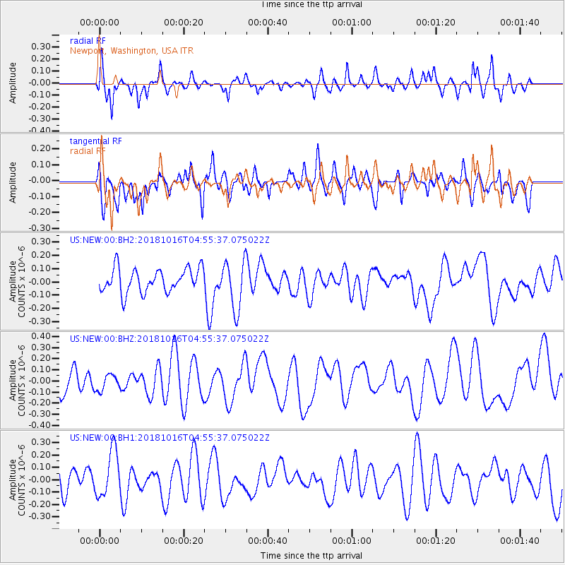
NEW Newport, Washington, USA - Earthquake Result Viewer
*The percent match for this event was below the threshold and hence no stack was calculated.
| Earthquake location: |
Southeast Of Loyalty Islands |
| Earthquake latitude/longitude: |
-21.9/169.4 |
| Earthquake time(UTC): |
2018/10/16 (289) 04:42:42 GMT |
| Earthquake Depth: |
10 km |
| Earthquake Magnitude: |
5.6 Mww |
| Earthquake Catalog/Contributor: |
NEIC PDE/us |
|
| Network: |
US United States National Seismic Network |
| Station: |
NEW Newport, Washington, USA |
| Lat/Lon: |
48.26 N/117.12 W |
| Elevation: |
760 m |
|
| Distance: |
95.7 deg |
| Az: |
40.067 deg |
| Baz: |
243.465 deg |
| Ray Param: |
$rayparam |
*The percent match for this event was below the threshold and hence was not used in the summary stack. |
|
| Radial Match: |
55.27255 % |
| Radial Bump: |
400 |
| Transverse Match: |
49.990353 % |
| Transverse Bump: |
400 |
| SOD ConfigId: |
3045211 |
| Insert Time: |
2018-10-30 04:55:28.622 +0000 |
| GWidth: |
2.5 |
| Max Bumps: |
400 |
| Tol: |
0.001 |
|
Signal To Noise
| Channel | StoN | STA | LTA |
| US:NEW:00:BHZ:20181016T04:55:37.075022Z | 0.4453052 | 6.9785784E-8 | 1.5671452E-7 |
| US:NEW:00:BH1:20181016T04:55:37.075022Z | 1.80194 | 1.9283681E-7 | 1.0701622E-7 |
| US:NEW:00:BH2:20181016T04:55:37.075022Z | 2.1243753 | 1.9005532E-7 | 8.9464095E-8 |
| Arrivals |
| Ps | |
| PpPs | |
| PsPs/PpSs | |


