You are here: Home > Network List > GS - US Geological Survey Networks Stations List
> Station OK031 S. Brethren Rd., Cushing, OK, USA > Earthquake Result Viewer
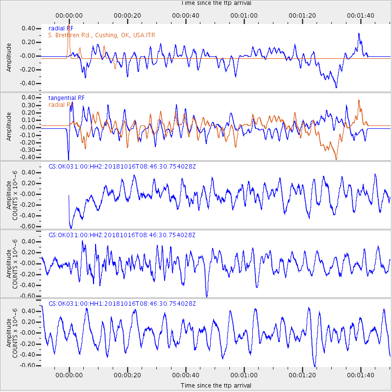
OK031 S. Brethren Rd., Cushing, OK, USA - Earthquake Result Viewer
*The percent match for this event was below the threshold and hence no stack was calculated.
| Earthquake location: |
Central Mid-Atlantic Ridge |
| Earthquake latitude/longitude: |
0.9/-28.2 |
| Earthquake time(UTC): |
2018/10/16 (289) 08:35:37 GMT |
| Earthquake Depth: |
10 km |
| Earthquake Magnitude: |
5.3 mb |
| Earthquake Catalog/Contributor: |
NEIC PDE/us |
|
| Network: |
GS US Geological Survey Networks |
| Station: |
OK031 S. Brethren Rd., Cushing, OK, USA |
| Lat/Lon: |
35.95 N/96.84 W |
| Elevation: |
290 m |
|
| Distance: |
72.2 deg |
| Az: |
307.498 deg |
| Baz: |
102.126 deg |
| Ray Param: |
$rayparam |
*The percent match for this event was below the threshold and hence was not used in the summary stack. |
|
| Radial Match: |
44.638027 % |
| Radial Bump: |
400 |
| Transverse Match: |
49.35181 % |
| Transverse Bump: |
400 |
| SOD ConfigId: |
3045211 |
| Insert Time: |
2018-10-30 08:47:00.657 +0000 |
| GWidth: |
2.5 |
| Max Bumps: |
400 |
| Tol: |
0.001 |
|
Signal To Noise
| Channel | StoN | STA | LTA |
| GS:OK031:00:HHZ:20181016T08:46:30.754028Z | 1.1006978 | 1.6122945E-7 | 1.4647931E-7 |
| GS:OK031:00:HH1:20181016T08:46:30.754028Z | 0.6301264 | 1.5404845E-7 | 2.4447232E-7 |
| GS:OK031:00:HH2:20181016T08:46:30.754028Z | 0.90379024 | 1.936534E-7 | 2.1426808E-7 |
| Arrivals |
| Ps | |
| PpPs | |
| PsPs/PpSs | |


