You are here: Home > Network List > US - United States National Seismic Network Stations List
> Station AMTX Amarillo, Texas, USA > Earthquake Result Viewer
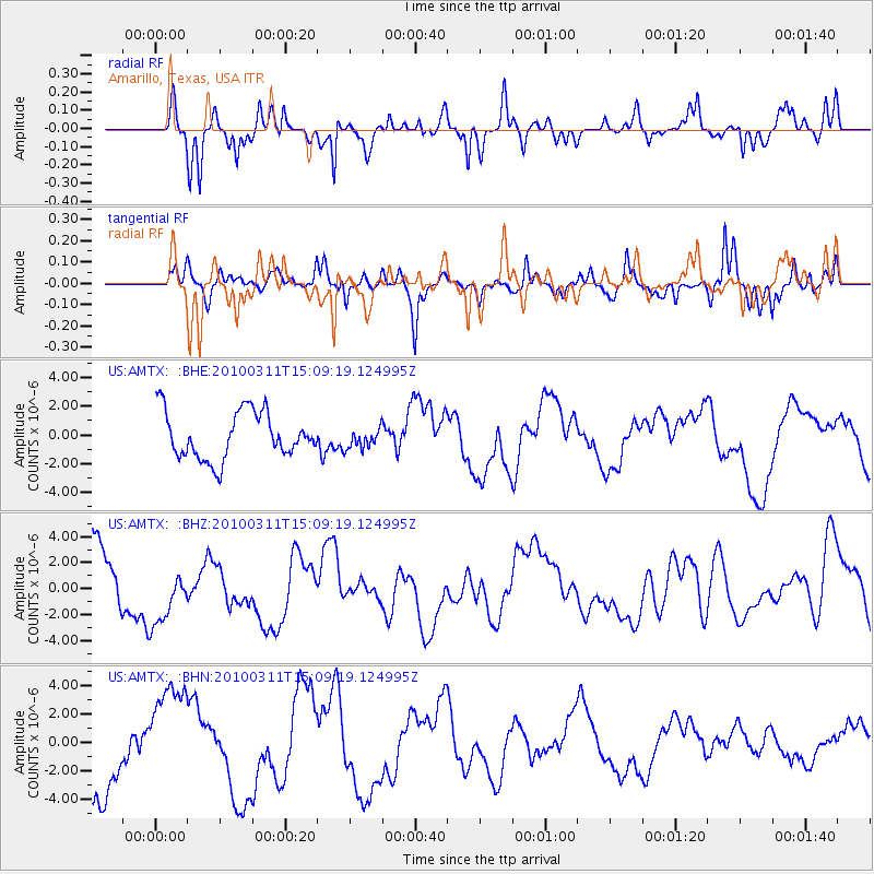
AMTX Amarillo, Texas, USA - Earthquake Result Viewer
*The percent match for this event was below the threshold and hence no stack was calculated.
| Earthquake location: |
Near Coast Of Central Chile |
| Earthquake latitude/longitude: |
-34.6/-72.0 |
| Earthquake time(UTC): |
2010/03/11 (070) 14:58:15 GMT |
| Earthquake Depth: |
35 km |
| Earthquake Magnitude: |
5.6 MB |
| Earthquake Catalog/Contributor: |
WHDF/NEIC |
|
| Network: |
US United States National Seismic Network |
| Station: |
AMTX Amarillo, Texas, USA |
| Lat/Lon: |
34.53 N/101.41 W |
| Elevation: |
1010 m |
|
| Distance: |
74.1 deg |
| Az: |
335.06 deg |
| Baz: |
155.087 deg |
| Ray Param: |
$rayparam |
*The percent match for this event was below the threshold and hence was not used in the summary stack. |
|
| Radial Match: |
46.315716 % |
| Radial Bump: |
316 |
| Transverse Match: |
67.97854 % |
| Transverse Bump: |
400 |
| SOD ConfigId: |
308276 |
| Insert Time: |
2010-06-22 17:37:06.388 +0000 |
| GWidth: |
2.5 |
| Max Bumps: |
400 |
| Tol: |
0.001 |
|
Signal To Noise
| Channel | StoN | STA | LTA |
| US:AMTX: :BHZ:20100311T15:09:19.124995Z | 0.8320514 | 2.1874905E-6 | 2.629033E-6 |
| US:AMTX: :BHN:20100311T15:09:19.124995Z | 1.2980523 | 3.946015E-6 | 3.0399508E-6 |
| US:AMTX: :BHE:20100311T15:09:19.124995Z | 0.44558623 | 7.648939E-7 | 1.7166013E-6 |
| Arrivals |
| Ps | |
| PpPs | |
| PsPs/PpSs | |


