You are here: Home > Network List > US - United States National Seismic Network Stations List
> Station EGMT Eagleton, Montana, USA > Earthquake Result Viewer
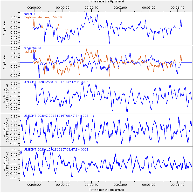
EGMT Eagleton, Montana, USA - Earthquake Result Viewer
*The percent match for this event was below the threshold and hence no stack was calculated.
| Earthquake location: |
Central Mid-Atlantic Ridge |
| Earthquake latitude/longitude: |
0.9/-28.2 |
| Earthquake time(UTC): |
2018/10/16 (289) 08:35:37 GMT |
| Earthquake Depth: |
10 km |
| Earthquake Magnitude: |
5.3 mb |
| Earthquake Catalog/Contributor: |
NEIC PDE/us |
|
| Network: |
US United States National Seismic Network |
| Station: |
EGMT Eagleton, Montana, USA |
| Lat/Lon: |
48.02 N/109.75 W |
| Elevation: |
1055 m |
|
| Distance: |
83.6 deg |
| Az: |
318.08 deg |
| Baz: |
95.683 deg |
| Ray Param: |
$rayparam |
*The percent match for this event was below the threshold and hence was not used in the summary stack. |
|
| Radial Match: |
52.426453 % |
| Radial Bump: |
400 |
| Transverse Match: |
60.113365 % |
| Transverse Bump: |
400 |
| SOD ConfigId: |
3045211 |
| Insert Time: |
2018-10-30 08:50:18.717 +0000 |
| GWidth: |
2.5 |
| Max Bumps: |
400 |
| Tol: |
0.001 |
|
Signal To Noise
| Channel | StoN | STA | LTA |
| US:EGMT:00:BHZ:20181016T08:47:34.000Z | 0.63901633 | 1.0540376E-7 | 1.649469E-7 |
| US:EGMT:00:BH1:20181016T08:47:34.000Z | 1.1626239 | 3.2395434E-7 | 2.786407E-7 |
| US:EGMT:00:BH2:20181016T08:47:34.000Z | 1.4651202 | 3.851176E-7 | 2.6285736E-7 |
| Arrivals |
| Ps | |
| PpPs | |
| PsPs/PpSs | |


