You are here: Home > Network List > IU - Global Seismograph Network (GSN - IRIS/USGS) Stations List
> Station SLBS Sierra la Laguna Baja California Sur, Mexico > Earthquake Result Viewer
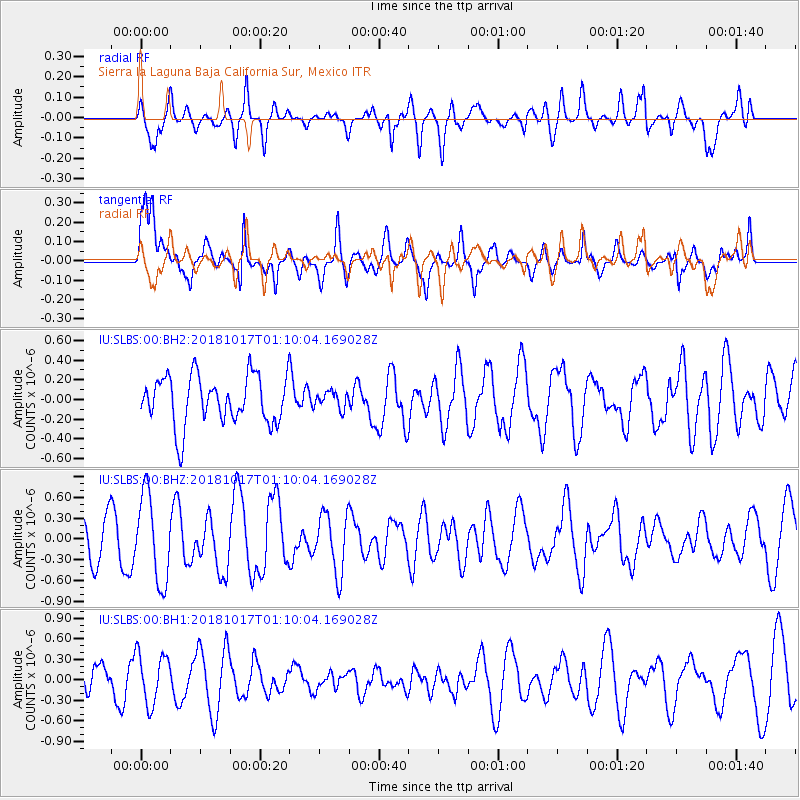
SLBS Sierra la Laguna Baja California Sur, Mexico - Earthquake Result Viewer
*The percent match for this event was below the threshold and hence no stack was calculated.
| Earthquake location: |
Santa Cruz Islands |
| Earthquake latitude/longitude: |
-11.6/166.2 |
| Earthquake time(UTC): |
2018/10/17 (290) 00:57:44 GMT |
| Earthquake Depth: |
35 km |
| Earthquake Magnitude: |
5.5 Mww |
| Earthquake Catalog/Contributor: |
NEIC PDE/us |
|
| Network: |
IU Global Seismograph Network (GSN - IRIS/USGS) |
| Station: |
SLBS Sierra la Laguna Baja California Sur, Mexico |
| Lat/Lon: |
23.69 N/109.94 W |
| Elevation: |
825 m |
|
| Distance: |
89.0 deg |
| Az: |
65.718 deg |
| Baz: |
256.967 deg |
| Ray Param: |
$rayparam |
*The percent match for this event was below the threshold and hence was not used in the summary stack. |
|
| Radial Match: |
57.643974 % |
| Radial Bump: |
400 |
| Transverse Match: |
72.631546 % |
| Transverse Bump: |
400 |
| SOD ConfigId: |
3045211 |
| Insert Time: |
2018-10-31 01:10:57.643 +0000 |
| GWidth: |
2.5 |
| Max Bumps: |
400 |
| Tol: |
0.001 |
|
Signal To Noise
| Channel | StoN | STA | LTA |
| IU:SLBS:00:BHZ:20181017T01:10:04.169028Z | 2.2445478 | 6.261463E-7 | 2.7896323E-7 |
| IU:SLBS:00:BH1:20181017T01:10:04.169028Z | 2.2807422 | 3.697464E-7 | 1.621167E-7 |
| IU:SLBS:00:BH2:20181017T01:10:04.169028Z | 0.34442678 | 8.4965045E-8 | 2.4668537E-7 |
| Arrivals |
| Ps | |
| PpPs | |
| PsPs/PpSs | |


