You are here: Home > Network List > US - United States National Seismic Network Stations List
> Station HLID Hailey, Idaho, USA > Earthquake Result Viewer
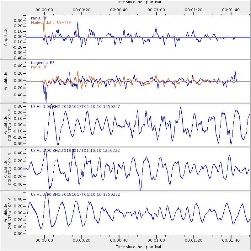
HLID Hailey, Idaho, USA - Earthquake Result Viewer
*The percent match for this event was below the threshold and hence no stack was calculated.
| Earthquake location: |
Santa Cruz Islands |
| Earthquake latitude/longitude: |
-11.6/166.2 |
| Earthquake time(UTC): |
2018/10/17 (290) 00:57:44 GMT |
| Earthquake Depth: |
35 km |
| Earthquake Magnitude: |
5.5 Mww |
| Earthquake Catalog/Contributor: |
NEIC PDE/us |
|
| Network: |
US United States National Seismic Network |
| Station: |
HLID Hailey, Idaho, USA |
| Lat/Lon: |
43.56 N/114.41 W |
| Elevation: |
1772 m |
|
| Distance: |
90.3 deg |
| Az: |
45.593 deg |
| Baz: |
254.347 deg |
| Ray Param: |
$rayparam |
*The percent match for this event was below the threshold and hence was not used in the summary stack. |
|
| Radial Match: |
64.50063 % |
| Radial Bump: |
377 |
| Transverse Match: |
66.573784 % |
| Transverse Bump: |
353 |
| SOD ConfigId: |
3045211 |
| Insert Time: |
2018-10-31 01:11:58.340 +0000 |
| GWidth: |
2.5 |
| Max Bumps: |
400 |
| Tol: |
0.001 |
|
Signal To Noise
| Channel | StoN | STA | LTA |
| US:HLID:00:BHZ:20181017T01:10:10.125022Z | 2.3940022 | 3.4966763E-7 | 1.4605986E-7 |
| US:HLID:00:BH1:20181017T01:10:10.125022Z | 2.1316025 | 3.765998E-7 | 1.7667449E-7 |
| US:HLID:00:BH2:20181017T01:10:10.125022Z | 0.4099628 | 6.642776E-8 | 1.6203363E-7 |
| Arrivals |
| Ps | |
| PpPs | |
| PsPs/PpSs | |


