You are here: Home > Network List > AZ - ANZA Regional Network Stations List
> Station LVA2 AZ.LVA2 > Earthquake Result Viewer
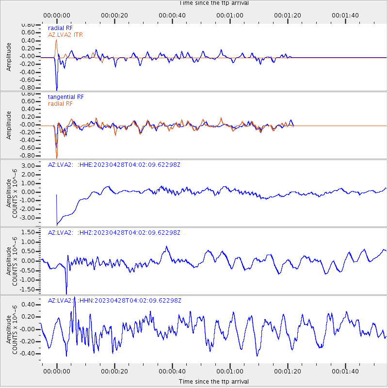
LVA2 AZ.LVA2 - Earthquake Result Viewer
*The percent match for this event was below the threshold and hence no stack was calculated.
| Earthquake location: |
South Of Fiji Islands |
| Earthquake latitude/longitude: |
-25.1/178.5 |
| Earthquake time(UTC): |
2023/04/28 (118) 03:51:06 GMT |
| Earthquake Depth: |
572 km |
| Earthquake Magnitude: |
5.5 mb |
| Earthquake Catalog/Contributor: |
NEIC PDE/us |
|
| Network: |
AZ ANZA Regional Network |
| Station: |
LVA2 AZ.LVA2 |
| Lat/Lon: |
33.35 N/116.56 W |
| Elevation: |
1435 m |
|
| Distance: |
84.8 deg |
| Az: |
49.599 deg |
| Baz: |
235.599 deg |
| Ray Param: |
$rayparam |
*The percent match for this event was below the threshold and hence was not used in the summary stack. |
|
| Radial Match: |
77.79715 % |
| Radial Bump: |
400 |
| Transverse Match: |
72.72929 % |
| Transverse Bump: |
400 |
| SOD ConfigId: |
30536071 |
| Insert Time: |
2023-05-12 04:04:16.449 +0000 |
| GWidth: |
2.5 |
| Max Bumps: |
400 |
| Tol: |
0.001 |
|
Signal To Noise
| Channel | StoN | STA | LTA |
| AZ:LVA2: :HHZ:20230428T04:02:09.62298Z | 1.0738294 | 1.0321219E-6 | 9.6116E-7 |
| AZ:LVA2: :HHN:20230428T04:02:09.62298Z | 0.9664317 | 2.02938E-7 | 2.0998691E-7 |
| AZ:LVA2: :HHE:20230428T04:02:09.62298Z | 0.77668357 | 9.971993E-7 | 1.2839198E-6 |
| Arrivals |
| Ps | |
| PpPs | |
| PsPs/PpSs | |


