You are here: Home > Network List > US - United States National Seismic Network Stations List
> Station GLMI Grayling, Michigan, USA > Earthquake Result Viewer
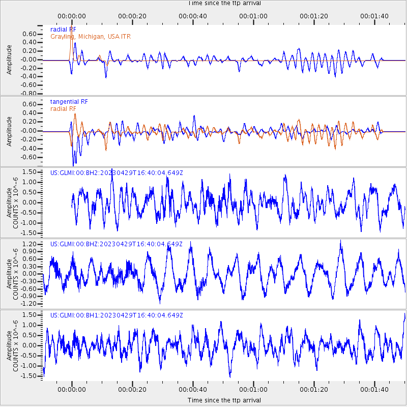
GLMI Grayling, Michigan, USA - Earthquake Result Viewer
*The percent match for this event was below the threshold and hence no stack was calculated.
| Earthquake location: |
Alaska Peninsula |
| Earthquake latitude/longitude: |
56.2/-156.7 |
| Earthquake time(UTC): |
2023/04/29 (119) 16:32:26 GMT |
| Earthquake Depth: |
77 km |
| Earthquake Magnitude: |
6.2 mb |
| Earthquake Catalog/Contributor: |
NEIC PDE/ak |
|
| Network: |
US United States National Seismic Network |
| Station: |
GLMI Grayling, Michigan, USA |
| Lat/Lon: |
44.82 N/84.62 W |
| Elevation: |
387 m |
|
| Distance: |
45.2 deg |
| Az: |
72.699 deg |
| Baz: |
311.435 deg |
| Ray Param: |
$rayparam |
*The percent match for this event was below the threshold and hence was not used in the summary stack. |
|
| Radial Match: |
50.82578 % |
| Radial Bump: |
400 |
| Transverse Match: |
69.8263 % |
| Transverse Bump: |
400 |
| SOD ConfigId: |
30536071 |
| Insert Time: |
2023-05-13 16:50:46.113 +0000 |
| GWidth: |
2.5 |
| Max Bumps: |
400 |
| Tol: |
0.001 |
|
Signal To Noise
| Channel | StoN | STA | LTA |
| US:GLMI:00:BHZ:20230429T16:40:04.649Z | 0.81115466 | 3.3513587E-7 | 4.13159E-7 |
| US:GLMI:00:BH1:20230429T16:40:04.649Z | 0.5982477 | 3.2935225E-7 | 5.505282E-7 |
| US:GLMI:00:BH2:20230429T16:40:04.649Z | 1.1290838 | 6.352122E-7 | 5.6259086E-7 |
| Arrivals |
| Ps | |
| PpPs | |
| PsPs/PpSs | |


