You are here: Home > Network List > CN - Canadian National Seismograph Network Stations List
> Station INK INUVIK, NT > Earthquake Result Viewer
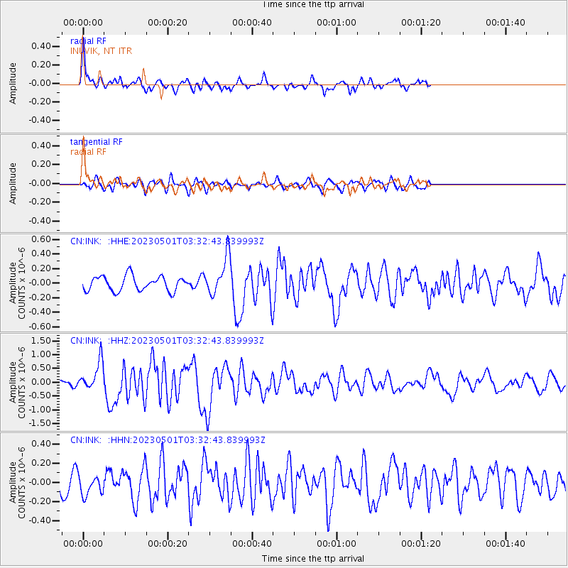
INK INUVIK, NT - Earthquake Result Viewer
*The percent match for this event was below the threshold and hence no stack was calculated.
| Earthquake location: |
Ryukyu Islands, Japan |
| Earthquake latitude/longitude: |
26.0/128.6 |
| Earthquake time(UTC): |
2023/05/01 (121) 03:22:09 GMT |
| Earthquake Depth: |
11 km |
| Earthquake Magnitude: |
5.9 mww |
| Earthquake Catalog/Contributor: |
NEIC PDE/us |
|
| Network: |
CN Canadian National Seismograph Network |
| Station: |
INK INUVIK, NT |
| Lat/Lon: |
68.31 N/133.53 W |
| Elevation: |
44 m |
|
| Distance: |
69.0 deg |
| Az: |
23.238 deg |
| Baz: |
287.253 deg |
| Ray Param: |
$rayparam |
*The percent match for this event was below the threshold and hence was not used in the summary stack. |
|
| Radial Match: |
78.83662 % |
| Radial Bump: |
348 |
| Transverse Match: |
66.61817 % |
| Transverse Bump: |
400 |
| SOD ConfigId: |
30536071 |
| Insert Time: |
2023-05-15 03:34:17.352 +0000 |
| GWidth: |
2.5 |
| Max Bumps: |
400 |
| Tol: |
0.001 |
|
Signal To Noise
| Channel | StoN | STA | LTA |
| CN:INK: :HHZ:20230501T03:32:43.839993Z | 6.7776237 | 5.4130254E-7 | 7.9866126E-8 |
| CN:INK: :HHN:20230501T03:32:43.839993Z | 1.3172407 | 1.0402889E-7 | 7.897485E-8 |
| CN:INK: :HHE:20230501T03:32:43.839993Z | 2.6479516 | 2.6592247E-7 | 1.0042572E-7 |
| Arrivals |
| Ps | |
| PpPs | |
| PsPs/PpSs | |


