You are here: Home > Network List > TA - USArray Transportable Network (new EarthScope stations) Stations List
> Station N26A Koester Ranch, Padroni, CO, USA > Earthquake Result Viewer
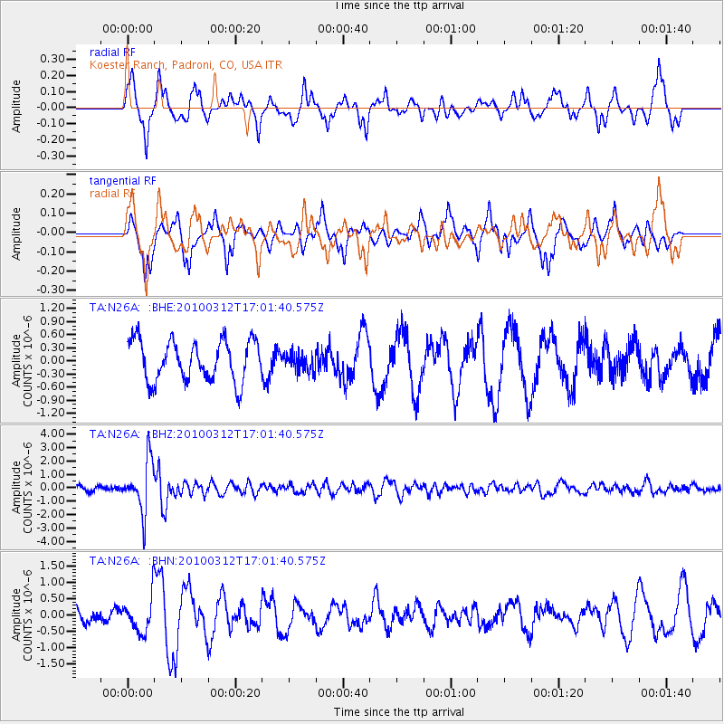
N26A Koester Ranch, Padroni, CO, USA - Earthquake Result Viewer
*The percent match for this event was below the threshold and hence no stack was calculated.
| Earthquake location: |
Near Coast Of Central Chile |
| Earthquake latitude/longitude: |
-34.2/-71.9 |
| Earthquake time(UTC): |
2010/03/12 (071) 16:50:01 GMT |
| Earthquake Depth: |
7.0 km |
| Earthquake Magnitude: |
6.1 MB, 5.4 MS, 5.8 MW, 5.7 MW |
| Earthquake Catalog/Contributor: |
WHDF/NEIC |
|
| Network: |
TA USArray Transportable Network (new EarthScope stations) |
| Station: |
N26A Koester Ranch, Padroni, CO, USA |
| Lat/Lon: |
40.83 N/103.22 W |
| Elevation: |
1284 m |
|
| Distance: |
80.1 deg |
| Az: |
336.404 deg |
| Baz: |
154.085 deg |
| Ray Param: |
$rayparam |
*The percent match for this event was below the threshold and hence was not used in the summary stack. |
|
| Radial Match: |
62.899586 % |
| Radial Bump: |
399 |
| Transverse Match: |
57.81633 % |
| Transverse Bump: |
358 |
| SOD ConfigId: |
308276 |
| Insert Time: |
2010-06-22 18:02:54.987 +0000 |
| GWidth: |
2.5 |
| Max Bumps: |
400 |
| Tol: |
0.001 |
|
Signal To Noise
| Channel | StoN | STA | LTA |
| TA:N26A: :BHZ:20100312T17:01:40.575Z | 8.082584 | 1.9253791E-6 | 2.382133E-7 |
| TA:N26A: :BHN:20100312T17:01:40.575Z | 1.5388113 | 5.46304E-7 | 3.550169E-7 |
| TA:N26A: :BHE:20100312T17:01:40.575Z | 0.45442814 | 2.0937031E-7 | 4.6073362E-7 |
| Arrivals |
| Ps | |
| PpPs | |
| PsPs/PpSs | |


