You are here: Home > Network List > UW - Pacific Northwest Regional Seismic Network Stations List
> Station UMAT Pilot Rock, OR, USA > Earthquake Result Viewer
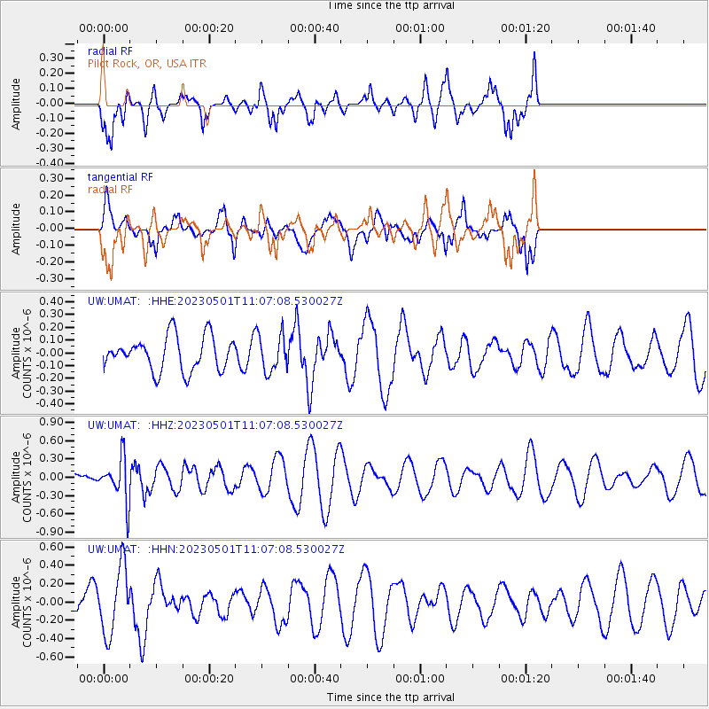
UMAT Pilot Rock, OR, USA - Earthquake Result Viewer
*The percent match for this event was below the threshold and hence no stack was calculated.
| Earthquake location: |
South Of Fiji Islands |
| Earthquake latitude/longitude: |
-22.1/-179.4 |
| Earthquake time(UTC): |
2023/05/01 (121) 10:55:55 GMT |
| Earthquake Depth: |
570 km |
| Earthquake Magnitude: |
5.6 Mww |
| Earthquake Catalog/Contributor: |
NEIC PDE/us |
|
| Network: |
UW Pacific Northwest Regional Seismic Network |
| Station: |
UMAT Pilot Rock, OR, USA |
| Lat/Lon: |
45.29 N/118.96 W |
| Elevation: |
1318 m |
|
| Distance: |
86.7 deg |
| Az: |
37.964 deg |
| Baz: |
233.899 deg |
| Ray Param: |
$rayparam |
*The percent match for this event was below the threshold and hence was not used in the summary stack. |
|
| Radial Match: |
80.8548 % |
| Radial Bump: |
400 |
| Transverse Match: |
44.954834 % |
| Transverse Bump: |
400 |
| SOD ConfigId: |
30536071 |
| Insert Time: |
2023-05-15 11:16:00.026 +0000 |
| GWidth: |
2.5 |
| Max Bumps: |
400 |
| Tol: |
0.001 |
|
Signal To Noise
| Channel | StoN | STA | LTA |
| UW:UMAT: :HHZ:20230501T11:07:08.530027Z | 2.5109193 | 3.622174E-7 | 1.4425689E-7 |
| UW:UMAT: :HHN:20230501T11:07:08.530027Z | 2.106124 | 3.6819378E-7 | 1.7482056E-7 |
| UW:UMAT: :HHE:20230501T11:07:08.530027Z | 1.105339 | 1.4680643E-7 | 1.3281574E-7 |
| Arrivals |
| Ps | |
| PpPs | |
| PsPs/PpSs | |


