You are here: Home > Network List > AV - Alaska Volcano Observatory Stations List
> Station MAPS Pakushin Southeast, Makushin Volcano, Alaska > Earthquake Result Viewer
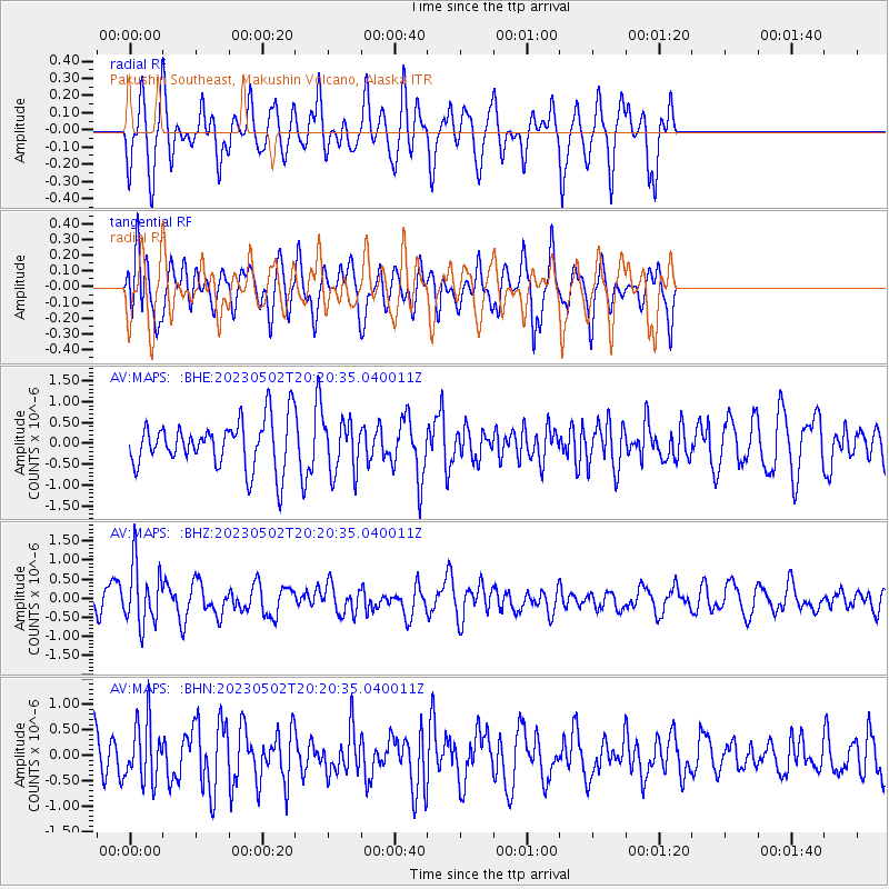
MAPS Pakushin Southeast, Makushin Volcano, Alaska - Earthquake Result Viewer
*The percent match for this event was below the threshold and hence no stack was calculated.
| Earthquake location: |
New Guinea, Papua New Guinea |
| Earthquake latitude/longitude: |
-4.1/142.7 |
| Earthquake time(UTC): |
2023/05/02 (122) 20:09:59 GMT |
| Earthquake Depth: |
120 km |
| Earthquake Magnitude: |
5.5 Mww |
| Earthquake Catalog/Contributor: |
NEIC PDE/us |
|
| Network: |
AV Alaska Volcano Observatory |
| Station: |
MAPS Pakushin Southeast, Makushin Volcano, Alaska |
| Lat/Lon: |
53.81 N/166.94 W |
| Elevation: |
333 m |
|
| Distance: |
71.3 deg |
| Az: |
28.819 deg |
| Baz: |
234.169 deg |
| Ray Param: |
$rayparam |
*The percent match for this event was below the threshold and hence was not used in the summary stack. |
|
| Radial Match: |
54.520313 % |
| Radial Bump: |
400 |
| Transverse Match: |
55.788975 % |
| Transverse Bump: |
400 |
| SOD ConfigId: |
30536071 |
| Insert Time: |
2023-05-16 20:17:12.369 +0000 |
| GWidth: |
2.5 |
| Max Bumps: |
400 |
| Tol: |
0.001 |
|
Signal To Noise
| Channel | StoN | STA | LTA |
| AV:MAPS: :BHZ:20230502T20:20:35.040011Z | 2.6159995 | 7.8233927E-7 | 2.9905942E-7 |
| AV:MAPS: :BHN:20230502T20:20:35.040011Z | 1.2974533 | 5.9845047E-7 | 4.6125007E-7 |
| AV:MAPS: :BHE:20230502T20:20:35.040011Z | 1.1242759 | 6.427965E-7 | 5.717427E-7 |
| Arrivals |
| Ps | |
| PpPs | |
| PsPs/PpSs | |


