You are here: Home > Network List > UW - Pacific Northwest Regional Seismic Network Stations List
> Station HOOD Mt Hood Meadows, OR CREST BB SMO > Earthquake Result Viewer
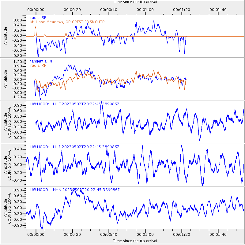
HOOD Mt Hood Meadows, OR CREST BB SMO - Earthquake Result Viewer
*The percent match for this event was below the threshold and hence no stack was calculated.
| Earthquake location: |
New Guinea, Papua New Guinea |
| Earthquake latitude/longitude: |
-4.1/142.7 |
| Earthquake time(UTC): |
2023/05/02 (122) 20:09:59 GMT |
| Earthquake Depth: |
120 km |
| Earthquake Magnitude: |
5.5 Mww |
| Earthquake Catalog/Contributor: |
NEIC PDE/us |
|
| Network: |
UW Pacific Northwest Regional Seismic Network |
| Station: |
HOOD Mt Hood Meadows, OR CREST BB SMO |
| Lat/Lon: |
45.32 N/121.65 W |
| Elevation: |
1520 m |
|
| Distance: |
96.8 deg |
| Az: |
45.003 deg |
| Baz: |
271.123 deg |
| Ray Param: |
$rayparam |
*The percent match for this event was below the threshold and hence was not used in the summary stack. |
|
| Radial Match: |
48.592335 % |
| Radial Bump: |
400 |
| Transverse Match: |
39.790592 % |
| Transverse Bump: |
400 |
| SOD ConfigId: |
30536071 |
| Insert Time: |
2023-05-16 20:25:31.310 +0000 |
| GWidth: |
2.5 |
| Max Bumps: |
400 |
| Tol: |
0.001 |
|
Signal To Noise
| Channel | StoN | STA | LTA |
| UW:HOOD: :HHZ:20230502T20:22:45.389986Z | 0.92018175 | 1.93934E-7 | 2.1075618E-7 |
| UW:HOOD: :HHN:20230502T20:22:45.389986Z | 1.6169286 | 7.305775E-7 | 4.518304E-7 |
| UW:HOOD: :HHE:20230502T20:22:45.389986Z | 0.65294963 | 1.6006277E-7 | 2.4513798E-7 |
| Arrivals |
| Ps | |
| PpPs | |
| PsPs/PpSs | |


