You are here: Home > Network List > G - GEOSCOPE Stations List
> Station TAM Tamanrasset, Algeria > Earthquake Result Viewer
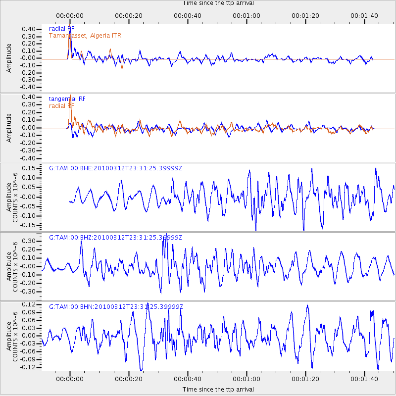
TAM Tamanrasset, Algeria - Earthquake Result Viewer
*The percent match for this event was below the threshold and hence no stack was calculated.
| Earthquake location: |
Myanmar-India Border Region |
| Earthquake latitude/longitude: |
23.1/94.6 |
| Earthquake time(UTC): |
2010/03/12 (071) 23:19:55 GMT |
| Earthquake Depth: |
102 km |
| Earthquake Magnitude: |
5.5 MB, 5.5 MW |
| Earthquake Catalog/Contributor: |
WHDF/NEIC |
|
| Network: |
G GEOSCOPE |
| Station: |
TAM Tamanrasset, Algeria |
| Lat/Lon: |
22.79 N/5.53 E |
| Elevation: |
1377 m |
|
| Distance: |
80.6 deg |
| Az: |
290.722 deg |
| Baz: |
68.981 deg |
| Ray Param: |
$rayparam |
*The percent match for this event was below the threshold and hence was not used in the summary stack. |
|
| Radial Match: |
70.35118 % |
| Radial Bump: |
400 |
| Transverse Match: |
60.270588 % |
| Transverse Bump: |
400 |
| SOD ConfigId: |
308276 |
| Insert Time: |
2010-06-22 18:27:31.771 +0000 |
| GWidth: |
2.5 |
| Max Bumps: |
400 |
| Tol: |
0.001 |
|
Signal To Noise
| Channel | StoN | STA | LTA |
| G:TAM:00:BHZ:20100312T23:31:25.39999Z | 2.0439813 | 1.0253776E-7 | 5.0165706E-8 |
| G:TAM:00:BHN:20100312T23:31:25.39999Z | 1.0103754 | 3.1406444E-8 | 3.1083935E-8 |
| G:TAM:00:BHE:20100312T23:31:25.39999Z | 0.9858768 | 3.3092334E-8 | 3.3566398E-8 |
| Arrivals |
| Ps | |
| PpPs | |
| PsPs/PpSs | |


