You are here: Home > Network List > II - Global Seismograph Network (GSN - IRIS/IDA) Stations List
> Station WRAB Tennant Creek, NT, Australia > Earthquake Result Viewer
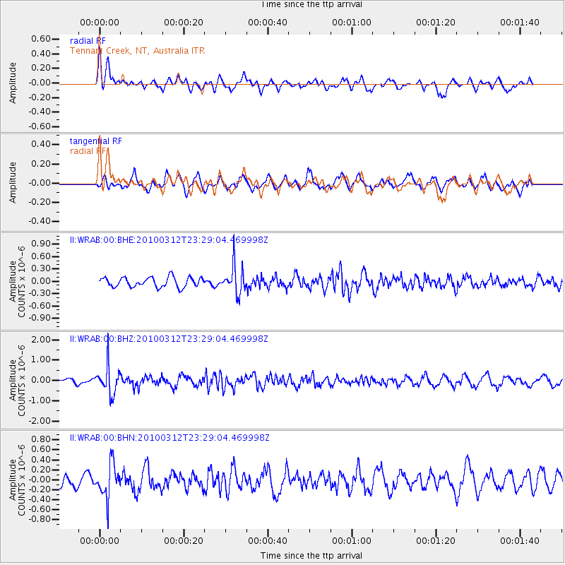
WRAB Tennant Creek, NT, Australia - Earthquake Result Viewer
*The percent match for this event was below the threshold and hence no stack was calculated.
| Earthquake location: |
Myanmar-India Border Region |
| Earthquake latitude/longitude: |
23.1/94.6 |
| Earthquake time(UTC): |
2010/03/12 (071) 23:19:55 GMT |
| Earthquake Depth: |
102 km |
| Earthquake Magnitude: |
5.5 MB, 5.5 MW |
| Earthquake Catalog/Contributor: |
WHDF/NEIC |
|
| Network: |
II Global Seismograph Network (GSN - IRIS/IDA) |
| Station: |
WRAB Tennant Creek, NT, Australia |
| Lat/Lon: |
19.93 S/134.36 E |
| Elevation: |
366 m |
|
| Distance: |
57.7 deg |
| Az: |
134.641 deg |
| Baz: |
315.849 deg |
| Ray Param: |
$rayparam |
*The percent match for this event was below the threshold and hence was not used in the summary stack. |
|
| Radial Match: |
44.926617 % |
| Radial Bump: |
388 |
| Transverse Match: |
51.707237 % |
| Transverse Bump: |
400 |
| SOD ConfigId: |
308276 |
| Insert Time: |
2010-06-22 18:28:01.547 +0000 |
| GWidth: |
2.5 |
| Max Bumps: |
400 |
| Tol: |
0.001 |
|
Signal To Noise
| Channel | StoN | STA | LTA |
| II:WRAB:00:BHZ:20100312T23:29:04.469998Z | 4.416272 | 6.920534E-7 | 1.5670533E-7 |
| II:WRAB:00:BHN:20100312T23:29:04.469998Z | 2.0065536 | 3.3880642E-7 | 1.6884992E-7 |
| II:WRAB:00:BHE:20100312T23:29:04.469998Z | 2.9466105 | 3.4377973E-7 | 1.16669554E-7 |
| Arrivals |
| Ps | |
| PpPs | |
| PsPs/PpSs | |


