You are here: Home > Network List > TA - USArray Transportable Network (new EarthScope stations) Stations List
> Station 632A Uvalde, TX, USA > Earthquake Result Viewer
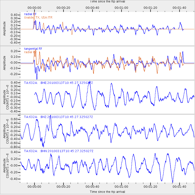
632A Uvalde, TX, USA - Earthquake Result Viewer
*The percent match for this event was below the threshold and hence no stack was calculated.
| Earthquake location: |
Near Coast Of Central Chile |
| Earthquake latitude/longitude: |
-37.6/-73.5 |
| Earthquake time(UTC): |
2010/03/13 (072) 10:34:43 GMT |
| Earthquake Depth: |
35 km |
| Earthquake Magnitude: |
5.5 MS, 5.2 MB, 5.8 MW, 5.7 MW |
| Earthquake Catalog/Contributor: |
WHDF/NEIC |
|
| Network: |
TA USArray Transportable Network (new EarthScope stations) |
| Station: |
632A Uvalde, TX, USA |
| Lat/Lon: |
29.51 N/99.79 W |
| Elevation: |
420 m |
|
| Distance: |
71.1 deg |
| Az: |
335.89 deg |
| Baz: |
158.133 deg |
| Ray Param: |
$rayparam |
*The percent match for this event was below the threshold and hence was not used in the summary stack. |
|
| Radial Match: |
73.03904 % |
| Radial Bump: |
400 |
| Transverse Match: |
66.11311 % |
| Transverse Bump: |
400 |
| SOD ConfigId: |
308276 |
| Insert Time: |
2010-06-22 18:37:34.761 +0000 |
| GWidth: |
2.5 |
| Max Bumps: |
400 |
| Tol: |
0.001 |
|
Signal To Noise
| Channel | StoN | STA | LTA |
| TA:632A: :BHZ:20100313T10:45:27.325027Z | 2.2661264 | 3.71817E-7 | 1.6407601E-7 |
| TA:632A: :BHN:20100313T10:45:27.325027Z | 0.8816135 | 1.08010354E-7 | 1.2251441E-7 |
| TA:632A: :BHE:20100313T10:45:27.325027Z | 1.9352039 | 2.4207327E-7 | 1.2508929E-7 |
| Arrivals |
| Ps | |
| PpPs | |
| PsPs/PpSs | |


