You are here: Home > Network List > TA - USArray Transportable Network (new EarthScope stations) Stations List
> Station H28A Mission Ridge, SD, USA > Earthquake Result Viewer
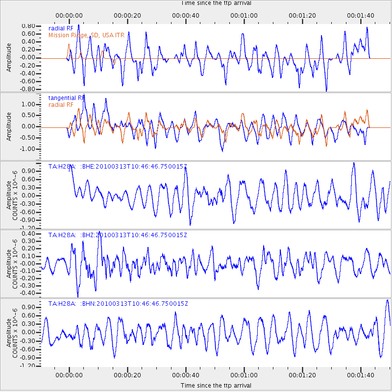
H28A Mission Ridge, SD, USA - Earthquake Result Viewer
*The percent match for this event was below the threshold and hence no stack was calculated.
| Earthquake location: |
Near Coast Of Central Chile |
| Earthquake latitude/longitude: |
-37.6/-73.5 |
| Earthquake time(UTC): |
2010/03/13 (072) 10:34:43 GMT |
| Earthquake Depth: |
35 km |
| Earthquake Magnitude: |
5.5 MS, 5.2 MB, 5.8 MW, 5.7 MW |
| Earthquake Catalog/Contributor: |
WHDF/NEIC |
|
| Network: |
TA USArray Transportable Network (new EarthScope stations) |
| Station: |
H28A Mission Ridge, SD, USA |
| Lat/Lon: |
44.68 N/101.02 W |
| Elevation: |
642 m |
|
| Distance: |
85.6 deg |
| Az: |
340.668 deg |
| Baz: |
158.359 deg |
| Ray Param: |
$rayparam |
*The percent match for this event was below the threshold and hence was not used in the summary stack. |
|
| Radial Match: |
55.64032 % |
| Radial Bump: |
400 |
| Transverse Match: |
56.01929 % |
| Transverse Bump: |
400 |
| SOD ConfigId: |
308276 |
| Insert Time: |
2010-06-22 18:38:01.597 +0000 |
| GWidth: |
2.5 |
| Max Bumps: |
400 |
| Tol: |
0.001 |
|
Signal To Noise
| Channel | StoN | STA | LTA |
| TA:H28A: :BHZ:20100313T10:46:46.750015Z | 2.9347103 | 2.0846535E-7 | 7.1034385E-8 |
| TA:H28A: :BHN:20100313T10:46:46.750015Z | 0.66202927 | 4.05442E-7 | 6.1242304E-7 |
| TA:H28A: :BHE:20100313T10:46:46.750015Z | 1.5000961 | 4.7926716E-7 | 3.19491E-7 |
| Arrivals |
| Ps | |
| PpPs | |
| PsPs/PpSs | |


