You are here: Home > Network List > G - GEOSCOPE Stations List
> Station INU Inuyama, Japan > Earthquake Result Viewer
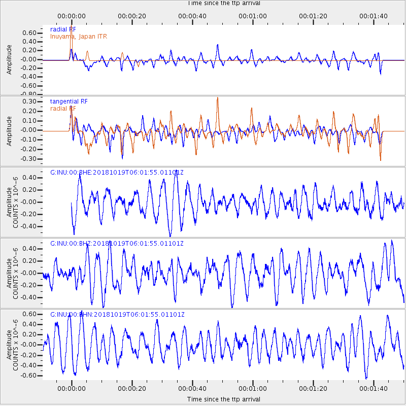
INU Inuyama, Japan - Earthquake Result Viewer
*The percent match for this event was below the threshold and hence no stack was calculated.
| Earthquake location: |
Near North Coast Of Irian Jaya |
| Earthquake latitude/longitude: |
-2.8/139.1 |
| Earthquake time(UTC): |
2018/10/19 (292) 05:55:12 GMT |
| Earthquake Depth: |
58 km |
| Earthquake Magnitude: |
5.5 Mww |
| Earthquake Catalog/Contributor: |
NEIC PDE/us |
|
| Network: |
G GEOSCOPE |
| Station: |
INU Inuyama, Japan |
| Lat/Lon: |
35.35 N/137.03 E |
| Elevation: |
132 m |
|
| Distance: |
38.0 deg |
| Az: |
357.229 deg |
| Baz: |
176.613 deg |
| Ray Param: |
$rayparam |
*The percent match for this event was below the threshold and hence was not used in the summary stack. |
|
| Radial Match: |
51.561752 % |
| Radial Bump: |
400 |
| Transverse Match: |
50.532852 % |
| Transverse Bump: |
365 |
| SOD ConfigId: |
3045211 |
| Insert Time: |
2018-11-07 12:28:53.506 +0000 |
| GWidth: |
2.5 |
| Max Bumps: |
400 |
| Tol: |
0.001 |
|
Signal To Noise
| Channel | StoN | STA | LTA |
| G:INU:00:BHZ:20181019T06:01:55.01101Z | 0.58469903 | 1.204374E-7 | 2.0598188E-7 |
| G:INU:00:BHN:20181019T06:01:55.01101Z | 2.4759278 | 4.3694263E-7 | 1.7647632E-7 |
| G:INU:00:BHE:20181019T06:01:55.01101Z | 1.9365336 | 3.48372E-7 | 1.7989463E-7 |
| Arrivals |
| Ps | |
| PpPs | |
| PsPs/PpSs | |


