You are here: Home > Network List > TA - USArray Transportable Network (new EarthScope stations) Stations List
> Station 334A Lometa, TX, USA > Earthquake Result Viewer
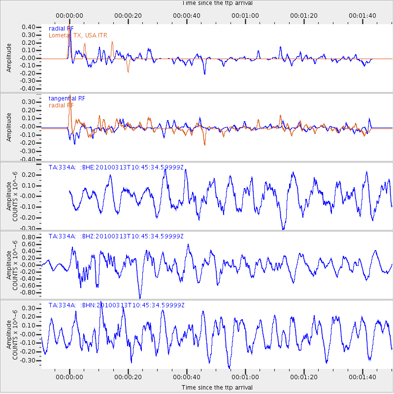
334A Lometa, TX, USA - Earthquake Result Viewer
*The percent match for this event was below the threshold and hence no stack was calculated.
| Earthquake location: |
Near Coast Of Central Chile |
| Earthquake latitude/longitude: |
-37.6/-73.5 |
| Earthquake time(UTC): |
2010/03/13 (072) 10:34:43 GMT |
| Earthquake Depth: |
35 km |
| Earthquake Magnitude: |
5.5 MS, 5.2 MB, 5.8 MW, 5.7 MW |
| Earthquake Catalog/Contributor: |
WHDF/NEIC |
|
| Network: |
TA USArray Transportable Network (new EarthScope stations) |
| Station: |
334A Lometa, TX, USA |
| Lat/Lon: |
31.33 N/98.24 W |
| Elevation: |
389 m |
|
| Distance: |
72.3 deg |
| Az: |
337.895 deg |
| Baz: |
159.542 deg |
| Ray Param: |
$rayparam |
*The percent match for this event was below the threshold and hence was not used in the summary stack. |
|
| Radial Match: |
58.720844 % |
| Radial Bump: |
400 |
| Transverse Match: |
57.58173 % |
| Transverse Bump: |
325 |
| SOD ConfigId: |
308276 |
| Insert Time: |
2010-06-22 18:39:42.069 +0000 |
| GWidth: |
2.5 |
| Max Bumps: |
400 |
| Tol: |
0.001 |
|
Signal To Noise
| Channel | StoN | STA | LTA |
| TA:334A: :BHZ:20100313T10:45:34.59999Z | 2.551485 | 3.0742902E-7 | 1.2049024E-7 |
| TA:334A: :BHN:20100313T10:45:34.59999Z | 0.9685921 | 1.2949799E-7 | 1.3369713E-7 |
| TA:334A: :BHE:20100313T10:45:34.59999Z | 1.7927529 | 1.4327948E-7 | 7.992149E-8 |
| Arrivals |
| Ps | |
| PpPs | |
| PsPs/PpSs | |


