You are here: Home > Network List > TA - USArray Transportable Network (new EarthScope stations) Stations List
> Station T27A Campo, CO, USA > Earthquake Result Viewer
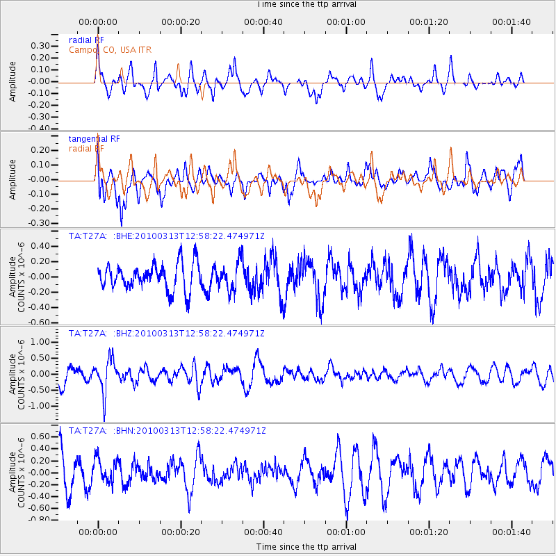
T27A Campo, CO, USA - Earthquake Result Viewer
*The percent match for this event was below the threshold and hence no stack was calculated.
| Earthquake location: |
Near East Coast Of Honshu, Japan |
| Earthquake latitude/longitude: |
37.6/141.3 |
| Earthquake time(UTC): |
2010/03/13 (072) 12:46:26 GMT |
| Earthquake Depth: |
77 km |
| Earthquake Magnitude: |
5.7 MB, 5.6 MW, 5.5 MW |
| Earthquake Catalog/Contributor: |
WHDF/NEIC |
|
| Network: |
TA USArray Transportable Network (new EarthScope stations) |
| Station: |
T27A Campo, CO, USA |
| Lat/Lon: |
37.06 N/102.72 W |
| Elevation: |
1366 m |
|
| Distance: |
85.1 deg |
| Az: |
46.202 deg |
| Baz: |
314.215 deg |
| Ray Param: |
$rayparam |
*The percent match for this event was below the threshold and hence was not used in the summary stack. |
|
| Radial Match: |
63.640106 % |
| Radial Bump: |
400 |
| Transverse Match: |
58.148083 % |
| Transverse Bump: |
400 |
| SOD ConfigId: |
308276 |
| Insert Time: |
2010-06-22 19:02:09.170 +0000 |
| GWidth: |
2.5 |
| Max Bumps: |
400 |
| Tol: |
0.001 |
|
Signal To Noise
| Channel | StoN | STA | LTA |
| TA:T27A: :BHZ:20100313T12:58:22.474971Z | 2.5171514 | 5.2868086E-7 | 2.100314E-7 |
| TA:T27A: :BHN:20100313T12:58:22.474971Z | 0.8465487 | 2.0599053E-7 | 2.4332982E-7 |
| TA:T27A: :BHE:20100313T12:58:22.474971Z | 1.0900617 | 1.8877371E-7 | 1.7317709E-7 |
| Arrivals |
| Ps | |
| PpPs | |
| PsPs/PpSs | |


