You are here: Home > Network List > US - United States National Seismic Network Stations List
> Station MSO Missoula, Montana, USA > Earthquake Result Viewer
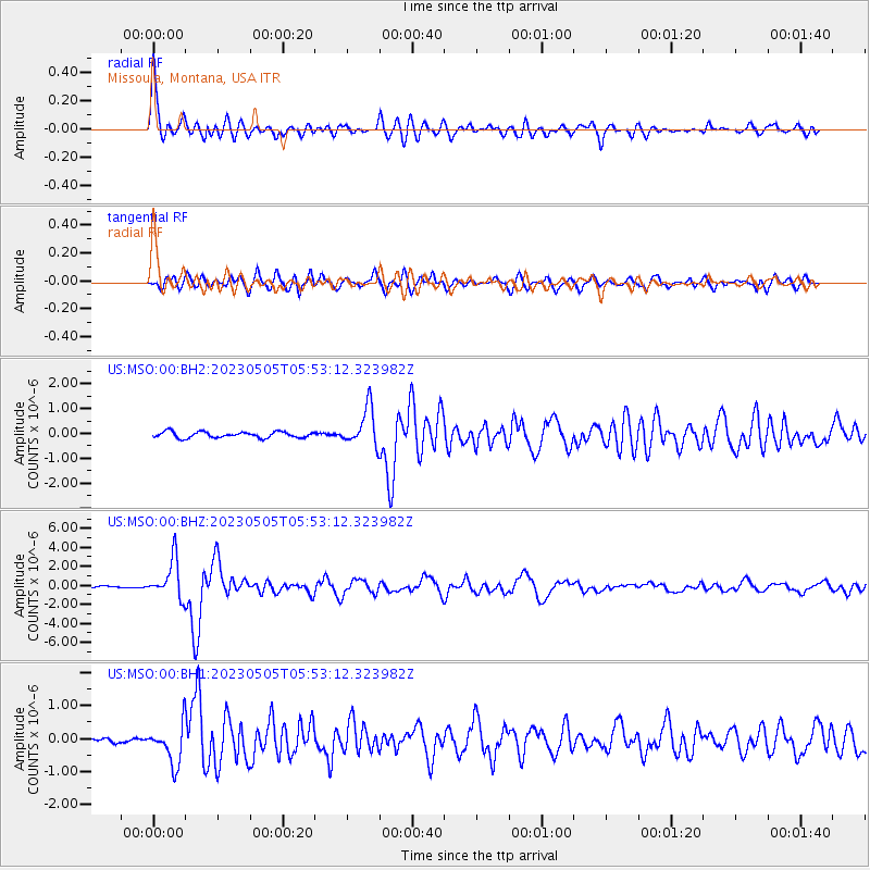
MSO Missoula, Montana, USA - Earthquake Result Viewer

| Earthquake location: |
Near West Coast Of Honshu, Japan |
| Earthquake latitude/longitude: |
37.5/137.3 |
| Earthquake time(UTC): |
2023/05/05 (125) 05:42:04 GMT |
| Earthquake Depth: |
8.7 km |
| Earthquake Magnitude: |
6.2 mww |
| Earthquake Catalog/Contributor: |
NEIC PDE/us |
|
| Network: |
US United States National Seismic Network |
| Station: |
MSO Missoula, Montana, USA |
| Lat/Lon: |
46.83 N/113.94 W |
| Elevation: |
1264 m |
|
| Distance: |
74.6 deg |
| Az: |
42.407 deg |
| Baz: |
308.671 deg |
| Ray Param: |
0.052239418 |
| Estimated Moho Depth: |
65.5 km |
| Estimated Crust Vp/Vs: |
1.91 |
| Assumed Crust Vp: |
6.353 km/s |
| Estimated Crust Vs: |
3.326 km/s |
| Estimated Crust Poisson's Ratio: |
0.31 |
|
| Radial Match: |
92.438225 % |
| Radial Bump: |
400 |
| Transverse Match: |
86.815 % |
| Transverse Bump: |
400 |
| SOD ConfigId: |
30536071 |
| Insert Time: |
2023-05-19 06:27:00.795 +0000 |
| GWidth: |
2.5 |
| Max Bumps: |
400 |
| Tol: |
0.001 |
|
Signal To Noise
| Channel | StoN | STA | LTA |
| US:MSO:00:BHZ:20230505T05:53:12.323982Z | 23.671892 | 2.031227E-6 | 8.580755E-8 |
| US:MSO:00:BH1:20230505T05:53:12.323982Z | 6.392238 | 5.9269144E-7 | 9.272049E-8 |
| US:MSO:00:BH2:20230505T05:53:12.323982Z | 6.401985 | 7.6241247E-7 | 1.19090004E-7 |
| Arrivals |
| Ps | 9.7 SECOND |
| PpPs | 29 SECOND |
| PsPs/PpSs | 39 SECOND |


