You are here: Home > Network List > TA - USArray Transportable Network (new EarthScope stations) Stations List
> Station S28A Manter, KS, USA > Earthquake Result Viewer
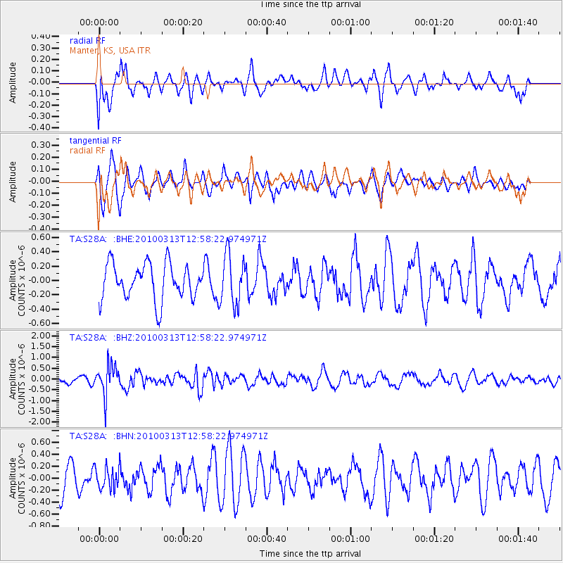
S28A Manter, KS, USA - Earthquake Result Viewer
*The percent match for this event was below the threshold and hence no stack was calculated.
| Earthquake location: |
Near East Coast Of Honshu, Japan |
| Earthquake latitude/longitude: |
37.6/141.3 |
| Earthquake time(UTC): |
2010/03/13 (072) 12:46:26 GMT |
| Earthquake Depth: |
77 km |
| Earthquake Magnitude: |
5.7 MB, 5.6 MW, 5.5 MW |
| Earthquake Catalog/Contributor: |
WHDF/NEIC |
|
| Network: |
TA USArray Transportable Network (new EarthScope stations) |
| Station: |
S28A Manter, KS, USA |
| Lat/Lon: |
37.59 N/101.90 W |
| Elevation: |
1064 m |
|
| Distance: |
85.2 deg |
| Az: |
45.363 deg |
| Baz: |
314.64 deg |
| Ray Param: |
$rayparam |
*The percent match for this event was below the threshold and hence was not used in the summary stack. |
|
| Radial Match: |
49.24879 % |
| Radial Bump: |
400 |
| Transverse Match: |
67.9818 % |
| Transverse Bump: |
400 |
| SOD ConfigId: |
308276 |
| Insert Time: |
2010-06-22 19:04:40.457 +0000 |
| GWidth: |
2.5 |
| Max Bumps: |
400 |
| Tol: |
0.001 |
|
Signal To Noise
| Channel | StoN | STA | LTA |
| TA:S28A: :BHZ:20100313T12:58:22.974971Z | 2.9676046 | 7.182344E-7 | 2.4202495E-7 |
| TA:S28A: :BHN:20100313T12:58:22.974971Z | 0.7818244 | 1.7807271E-7 | 2.2776561E-7 |
| TA:S28A: :BHE:20100313T12:58:22.974971Z | 1.3911017 | 3.4675904E-7 | 2.4926936E-7 |
| Arrivals |
| Ps | |
| PpPs | |
| PsPs/PpSs | |


