You are here: Home > Network List > TA - USArray Transportable Network (new EarthScope stations) Stations List
> Station P31A Stockton, KS, USA > Earthquake Result Viewer
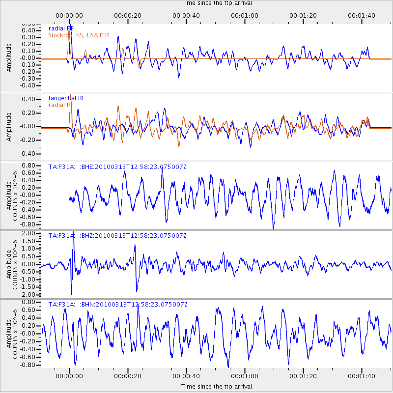
P31A Stockton, KS, USA - Earthquake Result Viewer
*The percent match for this event was below the threshold and hence no stack was calculated.
| Earthquake location: |
Near East Coast Of Honshu, Japan |
| Earthquake latitude/longitude: |
37.6/141.3 |
| Earthquake time(UTC): |
2010/03/13 (072) 12:46:26 GMT |
| Earthquake Depth: |
77 km |
| Earthquake Magnitude: |
5.7 MB, 5.6 MW, 5.5 MW |
| Earthquake Catalog/Contributor: |
WHDF/NEIC |
|
| Network: |
TA USArray Transportable Network (new EarthScope stations) |
| Station: |
P31A Stockton, KS, USA |
| Lat/Lon: |
39.52 N/99.38 W |
| Elevation: |
665 m |
|
| Distance: |
85.2 deg |
| Az: |
42.593 deg |
| Baz: |
315.971 deg |
| Ray Param: |
$rayparam |
*The percent match for this event was below the threshold and hence was not used in the summary stack. |
|
| Radial Match: |
51.33156 % |
| Radial Bump: |
400 |
| Transverse Match: |
53.16693 % |
| Transverse Bump: |
400 |
| SOD ConfigId: |
308276 |
| Insert Time: |
2010-06-22 19:05:44.703 +0000 |
| GWidth: |
2.5 |
| Max Bumps: |
400 |
| Tol: |
0.001 |
|
Signal To Noise
| Channel | StoN | STA | LTA |
| TA:P31A: :BHZ:20100313T12:58:23.075007Z | 4.499721 | 7.3802045E-7 | 1.6401471E-7 |
| TA:P31A: :BHN:20100313T12:58:23.075007Z | 0.9576593 | 3.518199E-7 | 3.673748E-7 |
| TA:P31A: :BHE:20100313T12:58:23.075007Z | 1.4199785 | 3.4961687E-7 | 2.462128E-7 |
| Arrivals |
| Ps | |
| PpPs | |
| PsPs/PpSs | |


