You are here: Home > Network List > TA - USArray Transportable Network (new EarthScope stations) Stations List
> Station X33A Lawton, OK, USA > Earthquake Result Viewer
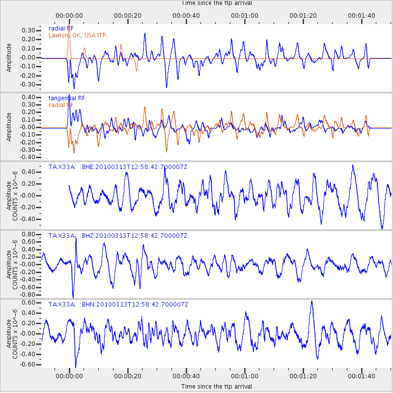
X33A Lawton, OK, USA - Earthquake Result Viewer
*The percent match for this event was below the threshold and hence no stack was calculated.
| Earthquake location: |
Near East Coast Of Honshu, Japan |
| Earthquake latitude/longitude: |
37.6/141.3 |
| Earthquake time(UTC): |
2010/03/13 (072) 12:46:26 GMT |
| Earthquake Depth: |
77 km |
| Earthquake Magnitude: |
5.7 MB, 5.6 MW, 5.5 MW |
| Earthquake Catalog/Contributor: |
WHDF/NEIC |
|
| Network: |
TA USArray Transportable Network (new EarthScope stations) |
| Station: |
X33A Lawton, OK, USA |
| Lat/Lon: |
34.54 N/98.50 W |
| Elevation: |
346 m |
|
| Distance: |
89.3 deg |
| Az: |
45.521 deg |
| Baz: |
316.641 deg |
| Ray Param: |
$rayparam |
*The percent match for this event was below the threshold and hence was not used in the summary stack. |
|
| Radial Match: |
60.972897 % |
| Radial Bump: |
400 |
| Transverse Match: |
58.698437 % |
| Transverse Bump: |
400 |
| SOD ConfigId: |
308276 |
| Insert Time: |
2010-06-22 19:11:31.187 +0000 |
| GWidth: |
2.5 |
| Max Bumps: |
400 |
| Tol: |
0.001 |
|
Signal To Noise
| Channel | StoN | STA | LTA |
| TA:X33A: :BHZ:20100313T12:58:42.700007Z | 2.0022087 | 3.123157E-7 | 1.5598559E-7 |
| TA:X33A: :BHN:20100313T12:58:42.700007Z | 2.817507 | 2.8336765E-7 | 1.0057389E-7 |
| TA:X33A: :BHE:20100313T12:58:42.700007Z | 1.6908852 | 2.3600793E-7 | 1.3957656E-7 |
| Arrivals |
| Ps | |
| PpPs | |
| PsPs/PpSs | |


