You are here: Home > Network List > US - United States National Seismic Network Stations List
> Station EGMT Eagleton, Montana, USA > Earthquake Result Viewer
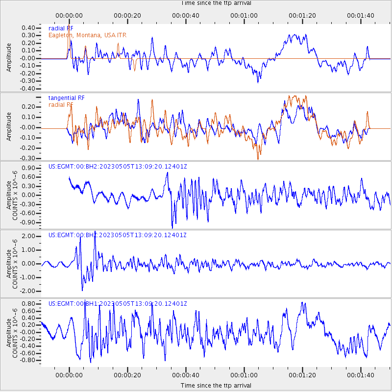
EGMT Eagleton, Montana, USA - Earthquake Result Viewer
*The percent match for this event was below the threshold and hence no stack was calculated.
| Earthquake location: |
Near West Coast Of Honshu, Japan |
| Earthquake latitude/longitude: |
37.5/137.3 |
| Earthquake time(UTC): |
2023/05/05 (125) 12:58:04 GMT |
| Earthquake Depth: |
14 km |
| Earthquake Magnitude: |
5.8 mb |
| Earthquake Catalog/Contributor: |
NEIC PDE/us |
|
| Network: |
US United States National Seismic Network |
| Station: |
EGMT Eagleton, Montana, USA |
| Lat/Lon: |
48.02 N/109.75 W |
| Elevation: |
1055 m |
|
| Distance: |
76.1 deg |
| Az: |
39.564 deg |
| Baz: |
311.003 deg |
| Ray Param: |
$rayparam |
*The percent match for this event was below the threshold and hence was not used in the summary stack. |
|
| Radial Match: |
41.47495 % |
| Radial Bump: |
400 |
| Transverse Match: |
70.08936 % |
| Transverse Bump: |
400 |
| SOD ConfigId: |
30536071 |
| Insert Time: |
2023-05-19 13:31:53.708 +0000 |
| GWidth: |
2.5 |
| Max Bumps: |
400 |
| Tol: |
0.001 |
|
Signal To Noise
| Channel | StoN | STA | LTA |
| US:EGMT:00:BHZ:20230505T13:09:20.12401Z | 7.175235 | 8.1934564E-7 | 1.14190776E-7 |
| US:EGMT:00:BH1:20230505T13:09:20.12401Z | 1.9576188 | 4.0986927E-7 | 2.0937134E-7 |
| US:EGMT:00:BH2:20230505T13:09:20.12401Z | 1.2250586 | 2.6832103E-7 | 2.1902709E-7 |
| Arrivals |
| Ps | |
| PpPs | |
| PsPs/PpSs | |


