You are here: Home > Network List > TA - USArray Transportable Network (new EarthScope stations) Stations List
> Station T26A Comanche National Grassland Park, Kim, CO, USA > Earthquake Result Viewer
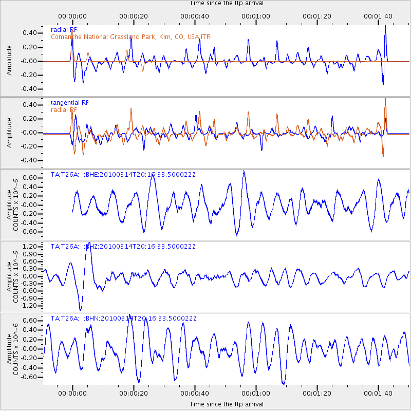
T26A Comanche National Grassland Park, Kim, CO, USA - Earthquake Result Viewer
*The percent match for this event was below the threshold and hence no stack was calculated.
| Earthquake location: |
Near Coast Of Central Chile |
| Earthquake latitude/longitude: |
-38.5/-73.5 |
| Earthquake time(UTC): |
2010/03/14 (073) 20:04:54 GMT |
| Earthquake Depth: |
13 km |
| Earthquake Magnitude: |
5.5 MB, 5.4 MS, 5.6 MW, 5.4 MW |
| Earthquake Catalog/Contributor: |
WHDF/NEIC |
|
| Network: |
TA USArray Transportable Network (new EarthScope stations) |
| Station: |
T26A Comanche National Grassland Park, Kim, CO, USA |
| Lat/Lon: |
37.17 N/103.59 W |
| Elevation: |
1830 m |
|
| Distance: |
80.3 deg |
| Az: |
336.051 deg |
| Baz: |
156.508 deg |
| Ray Param: |
$rayparam |
*The percent match for this event was below the threshold and hence was not used in the summary stack. |
|
| Radial Match: |
49.566963 % |
| Radial Bump: |
400 |
| Transverse Match: |
68.91672 % |
| Transverse Bump: |
400 |
| SOD ConfigId: |
308276 |
| Insert Time: |
2010-06-22 19:37:57.362 +0000 |
| GWidth: |
2.5 |
| Max Bumps: |
400 |
| Tol: |
0.001 |
|
Signal To Noise
| Channel | StoN | STA | LTA |
| TA:T26A: :BHZ:20100314T20:16:33.500022Z | 3.6603374 | 7.5996326E-7 | 2.0762108E-7 |
| TA:T26A: :BHN:20100314T20:16:33.500022Z | 1.1214111 | 2.5309487E-7 | 2.2569321E-7 |
| TA:T26A: :BHE:20100314T20:16:33.500022Z | 1.0684106 | 2.325271E-7 | 2.1763834E-7 |
| Arrivals |
| Ps | |
| PpPs | |
| PsPs/PpSs | |


