You are here: Home > Network List > GS - US Geological Survey Networks Stations List
> Station KAN13 Rinehart Farm > Earthquake Result Viewer
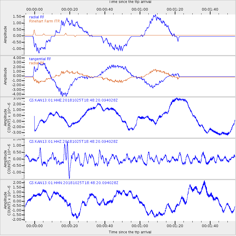
KAN13 Rinehart Farm - Earthquake Result Viewer
*The percent match for this event was below the threshold and hence no stack was calculated.
| Earthquake location: |
Near East Coast Of Honshu, Japan |
| Earthquake latitude/longitude: |
38.3/141.8 |
| Earthquake time(UTC): |
2018/10/25 (298) 18:36:09 GMT |
| Earthquake Depth: |
40 km |
| Earthquake Magnitude: |
5.7 Mww |
| Earthquake Catalog/Contributor: |
NEIC PDE/us |
|
| Network: |
GS US Geological Survey Networks |
| Station: |
KAN13 Rinehart Farm |
| Lat/Lon: |
37.01 N/97.48 W |
| Elevation: |
340 m |
|
| Distance: |
87.2 deg |
| Az: |
43.535 deg |
| Baz: |
317.397 deg |
| Ray Param: |
$rayparam |
*The percent match for this event was below the threshold and hence was not used in the summary stack. |
|
| Radial Match: |
45.24875 % |
| Radial Bump: |
400 |
| Transverse Match: |
45.032948 % |
| Transverse Bump: |
400 |
| SOD ConfigId: |
3103472 |
| Insert Time: |
2018-11-09 16:57:13.999 +0000 |
| GWidth: |
2.5 |
| Max Bumps: |
400 |
| Tol: |
0.001 |
|
Signal To Noise
| Channel | StoN | STA | LTA |
| GS:KAN13:01:HHZ:20181025T18:48:20.094028Z | 1.4050399 | 3.1028216E-7 | 2.2083512E-7 |
| GS:KAN13:01:HHN:20181025T18:48:20.094028Z | 2.4095488 | 1.3408056E-6 | 5.5645506E-7 |
| GS:KAN13:01:HHE:20181025T18:48:20.094028Z | 2.2987766 | 1.9315069E-6 | 8.402325E-7 |
| Arrivals |
| Ps | |
| PpPs | |
| PsPs/PpSs | |


