You are here: Home > Network List > US - United States National Seismic Network Stations List
> Station DGMT Dagmar, Montana, USA > Earthquake Result Viewer
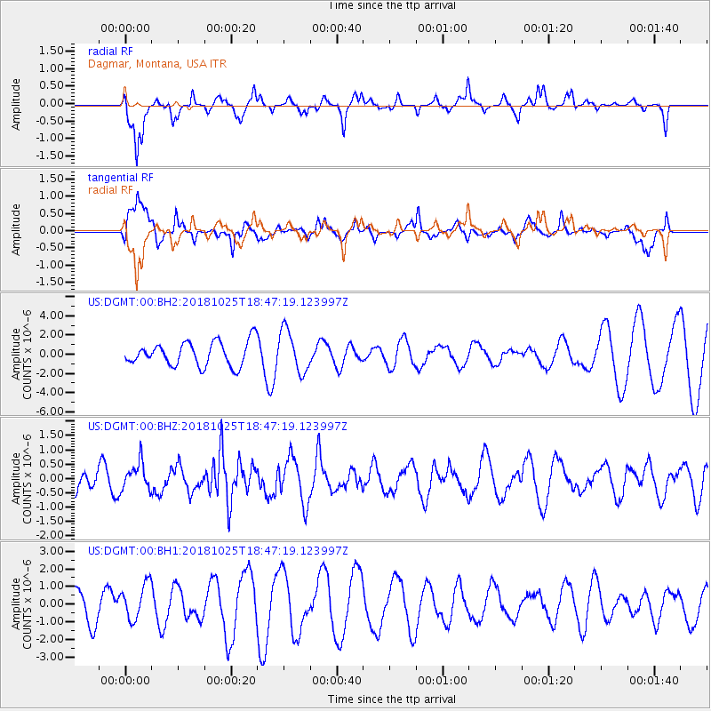
DGMT Dagmar, Montana, USA - Earthquake Result Viewer
*The percent match for this event was below the threshold and hence no stack was calculated.
| Earthquake location: |
Near East Coast Of Honshu, Japan |
| Earthquake latitude/longitude: |
38.3/141.8 |
| Earthquake time(UTC): |
2018/10/25 (298) 18:36:09 GMT |
| Earthquake Depth: |
40 km |
| Earthquake Magnitude: |
5.7 Mww |
| Earthquake Catalog/Contributor: |
NEIC PDE/us |
|
| Network: |
US United States National Seismic Network |
| Station: |
DGMT Dagmar, Montana, USA |
| Lat/Lon: |
48.47 N/104.20 W |
| Elevation: |
0.0 m |
|
| Distance: |
75.7 deg |
| Az: |
38.861 deg |
| Baz: |
312.13 deg |
| Ray Param: |
$rayparam |
*The percent match for this event was below the threshold and hence was not used in the summary stack. |
|
| Radial Match: |
71.74901 % |
| Radial Bump: |
373 |
| Transverse Match: |
82.33578 % |
| Transverse Bump: |
400 |
| SOD ConfigId: |
3103472 |
| Insert Time: |
2018-11-09 16:59:37.734 +0000 |
| GWidth: |
2.5 |
| Max Bumps: |
400 |
| Tol: |
0.001 |
|
Signal To Noise
| Channel | StoN | STA | LTA |
| US:DGMT:00:BHZ:20181025T18:47:19.123997Z | 1.3436929 | 4.8166845E-7 | 3.5846617E-7 |
| US:DGMT:00:BH1:20181025T18:47:19.123997Z | 0.9735293 | 1.0454413E-6 | 1.0738673E-6 |
| US:DGMT:00:BH2:20181025T18:47:19.123997Z | 1.7863889 | 2.2188888E-6 | 1.2421084E-6 |
| Arrivals |
| Ps | |
| PpPs | |
| PsPs/PpSs | |


