You are here: Home > Network List > CN - Canadian National Seismograph Network Stations List
> Station INK INUVIK, NT > Earthquake Result Viewer
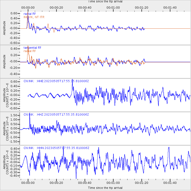
INK INUVIK, NT - Earthquake Result Viewer
*The percent match for this event was below the threshold and hence no stack was calculated.
| Earthquake location: |
Hokkaido, Japan Region |
| Earthquake latitude/longitude: |
41.5/142.0 |
| Earthquake time(UTC): |
2023/05/05 (125) 17:47:15 GMT |
| Earthquake Depth: |
53 km |
| Earthquake Magnitude: |
5.9 Mww |
| Earthquake Catalog/Contributor: |
NEIC PDE/us |
|
| Network: |
CN Canadian National Seismograph Network |
| Station: |
INK INUVIK, NT |
| Lat/Lon: |
68.31 N/133.53 W |
| Elevation: |
44 m |
|
| Distance: |
50.2 deg |
| Az: |
28.783 deg |
| Baz: |
283.441 deg |
| Ray Param: |
$rayparam |
*The percent match for this event was below the threshold and hence was not used in the summary stack. |
|
| Radial Match: |
64.43988 % |
| Radial Bump: |
400 |
| Transverse Match: |
53.035217 % |
| Transverse Bump: |
400 |
| SOD ConfigId: |
30536071 |
| Insert Time: |
2023-05-19 17:59:58.850 +0000 |
| GWidth: |
2.5 |
| Max Bumps: |
400 |
| Tol: |
0.001 |
|
Signal To Noise
| Channel | StoN | STA | LTA |
| CN:INK: :HHZ:20230505T17:55:35.810006Z | 4.6908994 | 4.4791764E-7 | 9.548652E-8 |
| CN:INK: :HHN:20230505T17:55:35.810006Z | 1.6161103 | 1.6983648E-7 | 1.05089654E-7 |
| CN:INK: :HHE:20230505T17:55:35.810006Z | 4.912219 | 2.53367E-7 | 5.1578933E-8 |
| Arrivals |
| Ps | |
| PpPs | |
| PsPs/PpSs | |


