You are here: Home > Network List > IW - Intermountain West Stations List
> Station MOOW Moose Ponds, Wyoming, USA > Earthquake Result Viewer
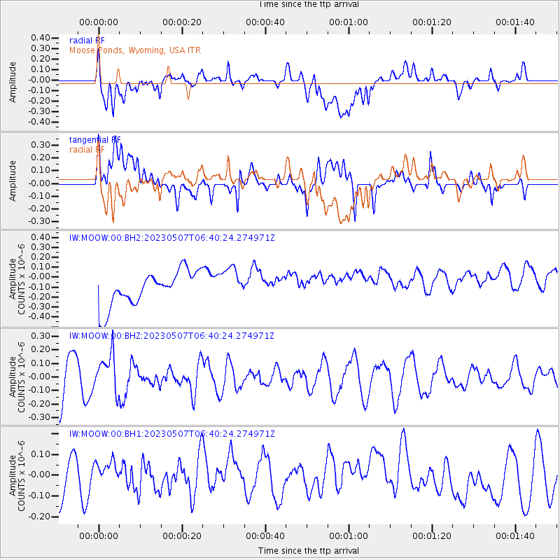
MOOW Moose Ponds, Wyoming, USA - Earthquake Result Viewer
*The percent match for this event was below the threshold and hence no stack was calculated.
| Earthquake location: |
Near Coast Of Northern Chile |
| Earthquake latitude/longitude: |
-25.4/-70.5 |
| Earthquake time(UTC): |
2023/05/07 (127) 06:29:00 GMT |
| Earthquake Depth: |
40 km |
| Earthquake Magnitude: |
5.2 Mww |
| Earthquake Catalog/Contributor: |
NEIC PDE/us |
|
| Network: |
IW Intermountain West |
| Station: |
MOOW Moose Ponds, Wyoming, USA |
| Lat/Lon: |
43.75 N/110.74 W |
| Elevation: |
2128 m |
|
| Distance: |
78.1 deg |
| Az: |
331.413 deg |
| Baz: |
143.317 deg |
| Ray Param: |
$rayparam |
*The percent match for this event was below the threshold and hence was not used in the summary stack. |
|
| Radial Match: |
50.496582 % |
| Radial Bump: |
400 |
| Transverse Match: |
45.883972 % |
| Transverse Bump: |
400 |
| SOD ConfigId: |
30536071 |
| Insert Time: |
2023-05-21 06:38:27.600 +0000 |
| GWidth: |
2.5 |
| Max Bumps: |
400 |
| Tol: |
0.001 |
|
Signal To Noise
| Channel | StoN | STA | LTA |
| IW:MOOW:00:BHZ:20230507T06:40:24.274971Z | 1.1146467 | 1.3951005E-7 | 1.2516078E-7 |
| IW:MOOW:00:BH1:20230507T06:40:24.274971Z | 0.5540523 | 5.6187467E-8 | 1.0141186E-7 |
| IW:MOOW:00:BH2:20230507T06:40:24.274971Z | 0.9682843 | 1.6639727E-7 | 1.7184753E-7 |
| Arrivals |
| Ps | |
| PpPs | |
| PsPs/PpSs | |


