You are here: Home > Network List > TA - USArray Transportable Network (new EarthScope stations) Stations List
> Station V26A Tequesquite Ranch, Mosquero, NM, USA > Earthquake Result Viewer
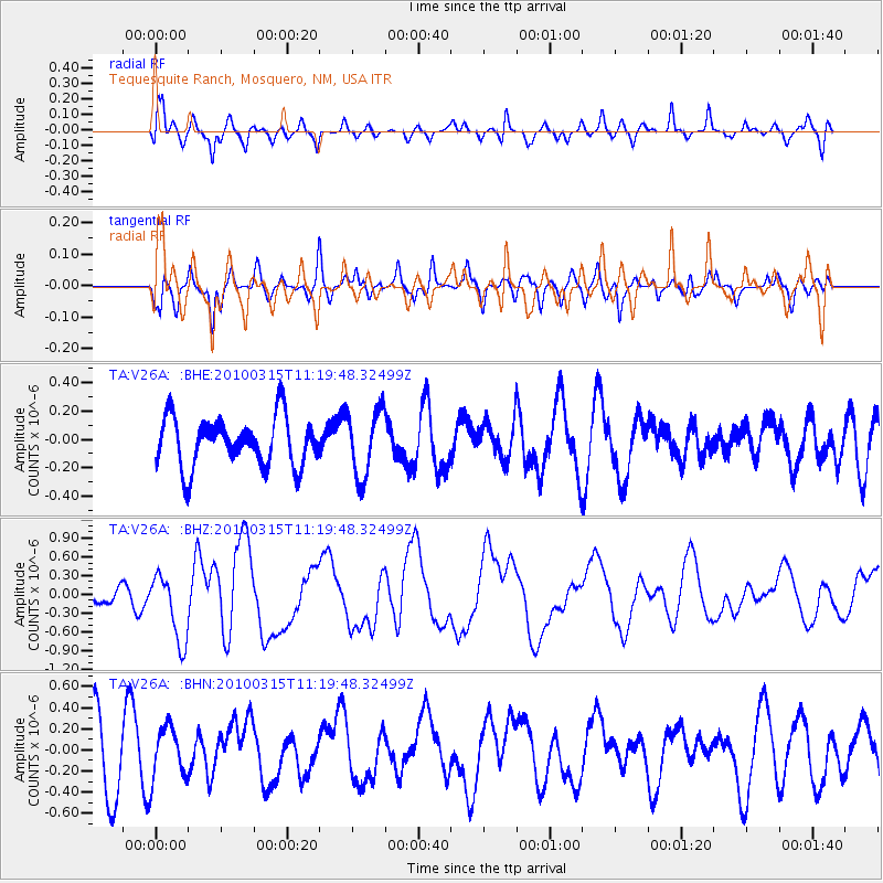
V26A Tequesquite Ranch, Mosquero, NM, USA - Earthquake Result Viewer
*The percent match for this event was below the threshold and hence no stack was calculated.
| Earthquake location: |
Off Coast Of Central Chile |
| Earthquake latitude/longitude: |
-35.8/-73.2 |
| Earthquake time(UTC): |
2010/03/15 (074) 11:08:28 GMT |
| Earthquake Depth: |
14 km |
| Earthquake Magnitude: |
5.9 MB, 6.1 MS, 6.2 MW, 6.1 MW |
| Earthquake Catalog/Contributor: |
WHDF/NEIC |
|
| Network: |
TA USArray Transportable Network (new EarthScope stations) |
| Station: |
V26A Tequesquite Ranch, Mosquero, NM, USA |
| Lat/Lon: |
35.80 N/103.79 W |
| Elevation: |
1362 m |
|
| Distance: |
76.7 deg |
| Az: |
334.816 deg |
| Baz: |
154.818 deg |
| Ray Param: |
$rayparam |
*The percent match for this event was below the threshold and hence was not used in the summary stack. |
|
| Radial Match: |
60.81992 % |
| Radial Bump: |
400 |
| Transverse Match: |
54.32098 % |
| Transverse Bump: |
400 |
| SOD ConfigId: |
308276 |
| Insert Time: |
2010-06-22 19:56:12.822 +0000 |
| GWidth: |
2.5 |
| Max Bumps: |
400 |
| Tol: |
0.001 |
|
Signal To Noise
| Channel | StoN | STA | LTA |
| TA:V26A: :BHZ:20100315T11:19:48.32499Z | 2.165767 | 5.379555E-7 | 2.4839028E-7 |
| TA:V26A: :BHN:20100315T11:19:48.32499Z | 0.8052088 | 2.505215E-7 | 3.1112614E-7 |
| TA:V26A: :BHE:20100315T11:19:48.32499Z | 1.3304024 | 2.3256713E-7 | 1.7480961E-7 |
| Arrivals |
| Ps | |
| PpPs | |
| PsPs/PpSs | |


