You are here: Home > Network List > TA - USArray Transportable Network (new EarthScope stations) Stations List
> Station S26A Kim, CO, USA > Earthquake Result Viewer
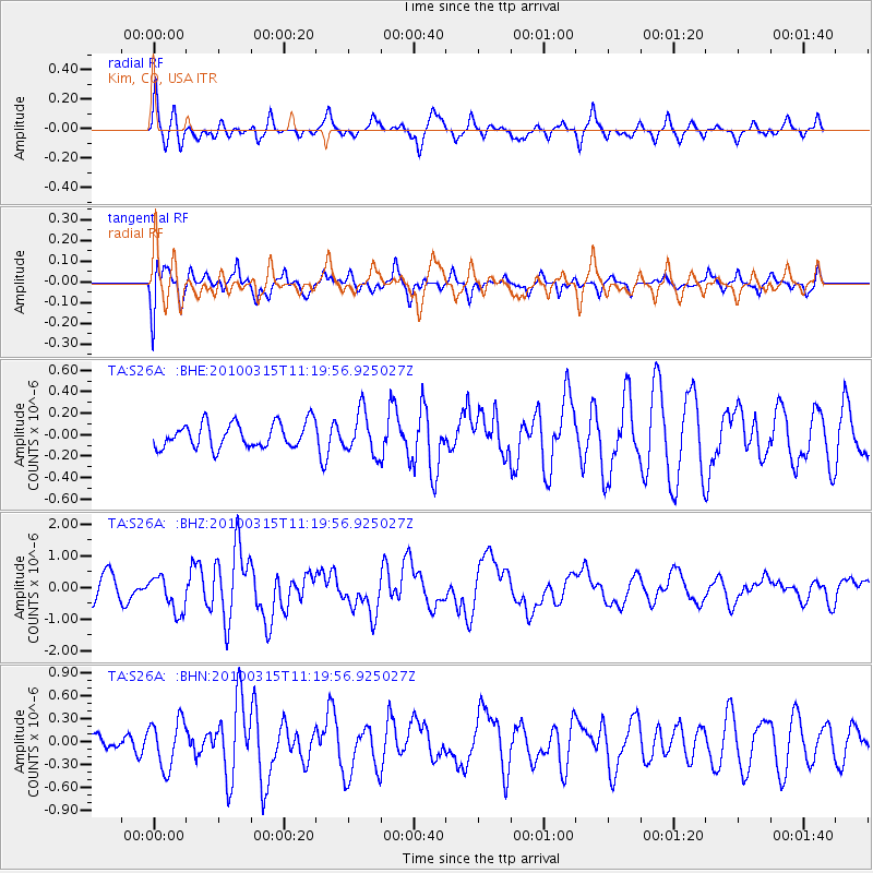
S26A Kim, CO, USA - Earthquake Result Viewer
*The percent match for this event was below the threshold and hence no stack was calculated.
| Earthquake location: |
Off Coast Of Central Chile |
| Earthquake latitude/longitude: |
-35.8/-73.2 |
| Earthquake time(UTC): |
2010/03/15 (074) 11:08:28 GMT |
| Earthquake Depth: |
14 km |
| Earthquake Magnitude: |
5.9 MB, 6.1 MS, 6.2 MW, 6.1 MW |
| Earthquake Catalog/Contributor: |
WHDF/NEIC |
|
| Network: |
TA USArray Transportable Network (new EarthScope stations) |
| Station: |
S26A Kim, CO, USA |
| Lat/Lon: |
37.62 N/103.47 W |
| Elevation: |
1394 m |
|
| Distance: |
78.3 deg |
| Az: |
335.839 deg |
| Baz: |
155.226 deg |
| Ray Param: |
$rayparam |
*The percent match for this event was below the threshold and hence was not used in the summary stack. |
|
| Radial Match: |
66.979904 % |
| Radial Bump: |
395 |
| Transverse Match: |
68.217705 % |
| Transverse Bump: |
400 |
| SOD ConfigId: |
308276 |
| Insert Time: |
2010-06-22 19:57:00.194 +0000 |
| GWidth: |
2.5 |
| Max Bumps: |
400 |
| Tol: |
0.001 |
|
Signal To Noise
| Channel | StoN | STA | LTA |
| TA:S26A: :BHZ:20100315T11:19:56.925027Z | 1.8257381 | 5.813348E-7 | 3.1841086E-7 |
| TA:S26A: :BHN:20100315T11:19:56.925027Z | 1.9187111 | 3.1123392E-7 | 1.6220989E-7 |
| TA:S26A: :BHE:20100315T11:19:56.925027Z | 1.7107698 | 1.9602969E-7 | 1.1458567E-7 |
| Arrivals |
| Ps | |
| PpPs | |
| PsPs/PpSs | |


