You are here: Home > Network List > TA - USArray Transportable Network (new EarthScope stations) Stations List
> Station X33A Lawton, OK, USA > Earthquake Result Viewer
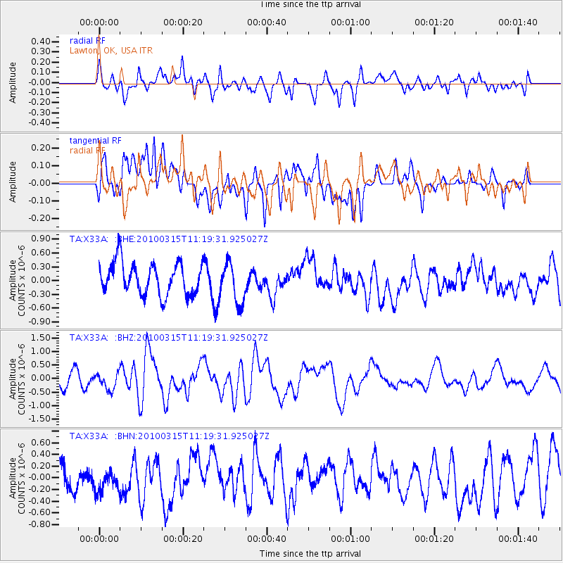
X33A Lawton, OK, USA - Earthquake Result Viewer
*The percent match for this event was below the threshold and hence no stack was calculated.
| Earthquake location: |
Off Coast Of Central Chile |
| Earthquake latitude/longitude: |
-35.8/-73.2 |
| Earthquake time(UTC): |
2010/03/15 (074) 11:08:28 GMT |
| Earthquake Depth: |
14 km |
| Earthquake Magnitude: |
5.9 MB, 6.1 MS, 6.2 MW, 6.1 MW |
| Earthquake Catalog/Contributor: |
WHDF/NEIC |
|
| Network: |
TA USArray Transportable Network (new EarthScope stations) |
| Station: |
X33A Lawton, OK, USA |
| Lat/Lon: |
34.54 N/98.50 W |
| Elevation: |
346 m |
|
| Distance: |
73.9 deg |
| Az: |
338.419 deg |
| Baz: |
158.765 deg |
| Ray Param: |
$rayparam |
*The percent match for this event was below the threshold and hence was not used in the summary stack. |
|
| Radial Match: |
54.78502 % |
| Radial Bump: |
400 |
| Transverse Match: |
52.659237 % |
| Transverse Bump: |
400 |
| SOD ConfigId: |
308276 |
| Insert Time: |
2010-06-22 19:59:45.023 +0000 |
| GWidth: |
2.5 |
| Max Bumps: |
400 |
| Tol: |
0.001 |
|
Signal To Noise
| Channel | StoN | STA | LTA |
| TA:X33A: :BHZ:20100315T11:19:31.925027Z | 1.47287 | 3.154485E-7 | 2.1417266E-7 |
| TA:X33A: :BHN:20100315T11:19:31.925027Z | 0.9364404 | 2.8651863E-7 | 3.059657E-7 |
| TA:X33A: :BHE:20100315T11:19:31.925027Z | 1.2984043 | 4.480768E-7 | 3.4509804E-7 |
| Arrivals |
| Ps | |
| PpPs | |
| PsPs/PpSs | |


