
TAM Tamanrasset, Algeria - Earthquake Result Viewer
| ||||||||||||||||||
| ||||||||||||||||||
| ||||||||||||||||||
|
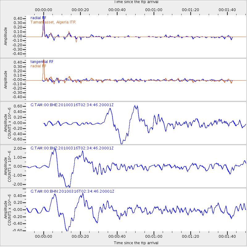
Signal To Noise
| Channel | StoN | STA | LTA |
| G:TAM:00:BHZ:20100316T02:34:46.20001Z | 10.733328 | 6.477843E-7 | 6.0352605E-8 |
| G:TAM:00:BHN:20100316T02:34:46.20001Z | 3.6717508 | 1.4093585E-7 | 3.8383828E-8 |
| G:TAM:00:BHE:20100316T02:34:46.20001Z | 3.7775843 | 1.48014E-7 | 3.9182183E-8 |
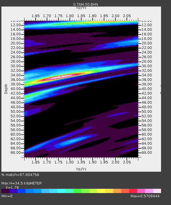
| Arrivals | |
| Ps | 4.1 SECOND |
| PpPs | 14 SECOND |
| PsPs/PpSs | 18 SECOND |

