You are here: Home > Network List > AV - Alaska Volcano Observatory Stations List
> Station AMKA Regional Station, Amchitka Island, Alaska > Earthquake Result Viewer
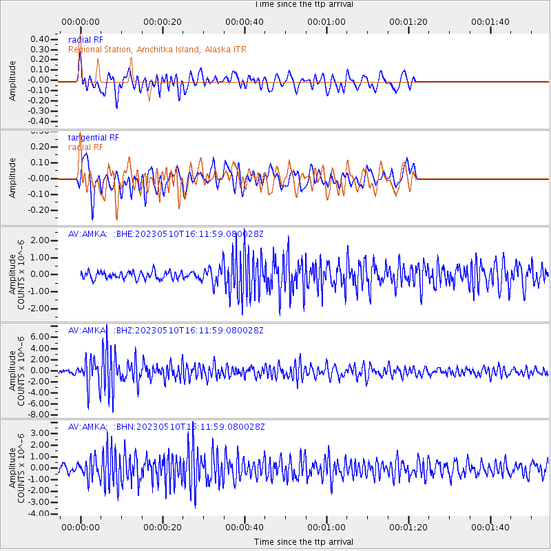
AMKA Regional Station, Amchitka Island, Alaska - Earthquake Result Viewer
*The percent match for this event was below the threshold and hence no stack was calculated.
| Earthquake location: |
Tonga Islands |
| Earthquake latitude/longitude: |
-15.6/-174.6 |
| Earthquake time(UTC): |
2023/05/10 (130) 16:02:00 GMT |
| Earthquake Depth: |
210 km |
| Earthquake Magnitude: |
7.6 mww |
| Earthquake Catalog/Contributor: |
NEIC PDE/us |
|
| Network: |
AV Alaska Volcano Observatory |
| Station: |
AMKA Regional Station, Amchitka Island, Alaska |
| Lat/Lon: |
51.38 N/179.30 E |
| Elevation: |
116 m |
|
| Distance: |
66.9 deg |
| Az: |
355.855 deg |
| Baz: |
173.619 deg |
| Ray Param: |
$rayparam |
*The percent match for this event was below the threshold and hence was not used in the summary stack. |
|
| Radial Match: |
73.989235 % |
| Radial Bump: |
400 |
| Transverse Match: |
77.29978 % |
| Transverse Bump: |
400 |
| SOD ConfigId: |
30536071 |
| Insert Time: |
2023-05-24 16:09:46.605 +0000 |
| GWidth: |
2.5 |
| Max Bumps: |
400 |
| Tol: |
0.001 |
|
Signal To Noise
| Channel | StoN | STA | LTA |
| AV:AMKA: :BHZ:20230510T16:11:59.080028Z | 7.2815723 | 2.3147998E-6 | 3.1789833E-7 |
| AV:AMKA: :BHN:20230510T16:11:59.080028Z | 2.4361236 | 7.825589E-7 | 3.212312E-7 |
| AV:AMKA: :BHE:20230510T16:11:59.080028Z | 2.289126 | 4.880954E-7 | 2.1322349E-7 |
| Arrivals |
| Ps | |
| PpPs | |
| PsPs/PpSs | |


