SUR Sutherland, South Africa - Earthquake Result Viewer
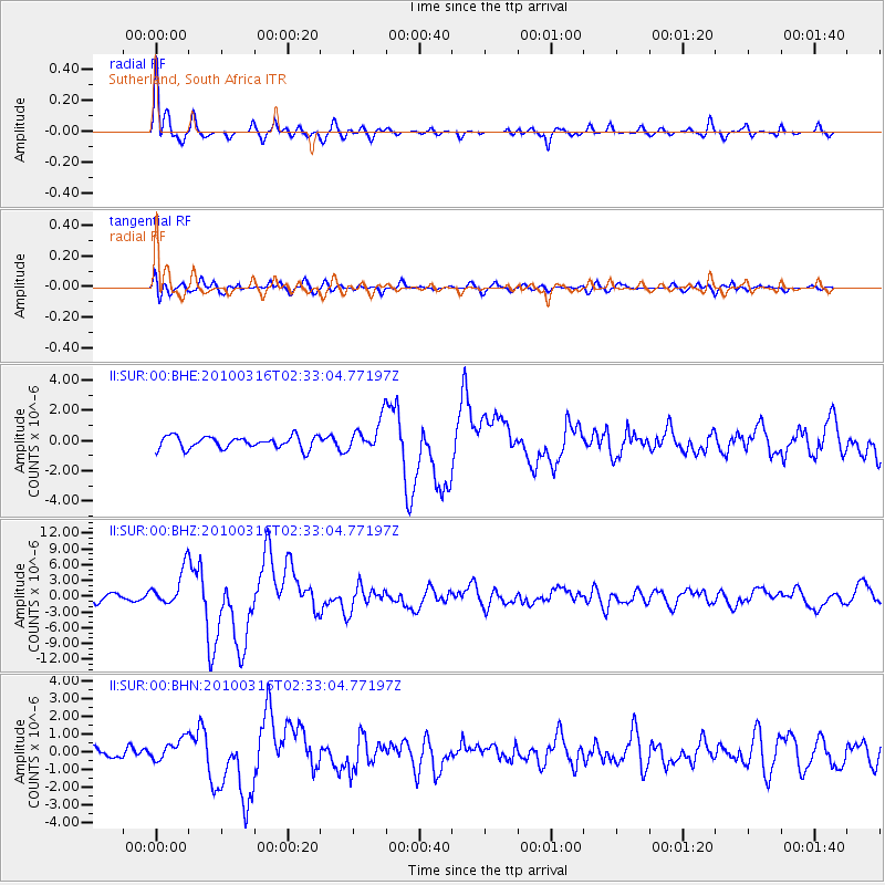
Earthquake location: Near Coast Of Central Chile
Earthquake latitude/longitude: -36.2/-73.3
Earthquake time(UTC): 2010/03/16 (075) 02:21:57 GMT
Earthquake Depth: 18 km
Earthquake Magnitude: 6.0 MB, 6.7 MS, 6.7 MW, 6.6 MW
Earthquake Catalog/Contributor: WHDF/NEIC
Network: II Global Seismograph Network (GSN - IRIS/IDA)
Station: SUR Sutherland, South Africa
Lat/Lon: 32.38 S/20.81 E
Elevation: 1770 m
Distance: 74.6 deg
Az: 118.92 deg
Baz: 236.776 deg
Ray Param: 0.052185845
Estimated Moho Depth: 14.0 km
Estimated Crust Vp/Vs: 1.78
Assumed Crust Vp: 6.51 km/s
Estimated Crust Vs: 3.663 km/s
Estimated Crust Poisson's Ratio: 0.27
Radial Match: 91.35291 %
Radial Bump: 381
Transverse Match: 72.46613 %
Transverse Bump: 400
SOD ConfigId: 308276
Insert Time: 2010-06-22 20:05:00.628 +0000
GWidth: 2.5
Max Bumps: 400
Tol: 0.001

Signal To Noise

ChannelStoNSTALTA
II:SUR:00:BHZ:20100316T02:33:04.77197Z6.6421553.5173055E-65.295428E-7
II:SUR:00:BHN:20100316T02:33:04.77197Z1.93662376.241896E-73.2230815E-7
II:SUR:00:BHE:20100316T02:33:04.77197Z2.56772111.0266572E-63.9983206E-7
Arrivals
Ps1.7 SECOND
PpPs5.8 SECOND
PsPs/PpSs7.5 SECOND