You are here: Home > Network List > AV - Alaska Volcano Observatory Stations List
> Station PLK2 Mt. Peulik Volcano 2, Alaska > Earthquake Result Viewer
PLK2 Mt. Peulik Volcano 2, Alaska - Earthquake Result Viewer

| Earthquake location: |
Tonga Islands |
| Earthquake latitude/longitude: |
-15.6/-174.6 |
| Earthquake time(UTC): |
2023/05/10 (130) 16:02:00 GMT |
| Earthquake Depth: |
210 km |
| Earthquake Magnitude: |
7.6 mww |
| Earthquake Catalog/Contributor: |
NEIC PDE/us |
|
| Network: |
AV Alaska Volcano Observatory |
| Station: |
PLK2 Mt. Peulik Volcano 2, Alaska |
| Lat/Lon: |
57.76 N/156.33 W |
| Elevation: |
401 m |
|
| Distance: |
74.6 deg |
| Az: |
10.041 deg |
| Baz: |
198.268 deg |
| Ray Param: |
0.051647224 |
| Estimated Moho Depth: |
61.25 km |
| Estimated Crust Vp/Vs: |
2.10 |
| Assumed Crust Vp: |
6.1 km/s |
| Estimated Crust Vs: |
2.908 km/s |
| Estimated Crust Poisson's Ratio: |
0.35 |
|
| Radial Match: |
92.87767 % |
| Radial Bump: |
400 |
| Transverse Match: |
79.87515 % |
| Transverse Bump: |
400 |
| SOD ConfigId: |
30536071 |
| Insert Time: |
2023-05-24 16:12:10.424 +0000 |
| GWidth: |
2.5 |
| Max Bumps: |
400 |
| Tol: |
0.001 |
|
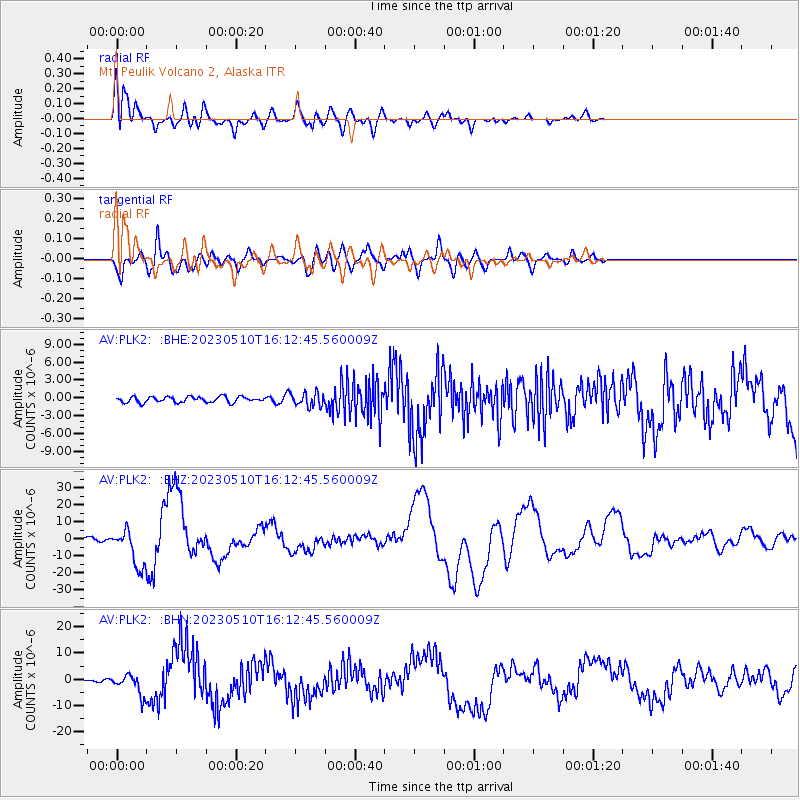
Signal To Noise
| Channel | StoN | STA | LTA |
| AV:PLK2: :BHZ:20230510T16:12:45.560009Z | 6.0064573 | 1.0927444E-5 | 1.8192828E-6 |
| AV:PLK2: :BHN:20230510T16:12:45.560009Z | 4.0280285 | 3.786754E-6 | 9.40101E-7 |
| AV:PLK2: :BHE:20230510T16:12:45.560009Z | 2.3553543 | 1.1431314E-6 | 4.853331E-7 |
| Arrivals |
| Ps | 11 SECOND |
| PpPs | 30 SECOND |
| PsPs/PpSs | 42 SECOND |


