SLBS Sierra la Laguna Baja California Sur, Mexico - Earthquake Result Viewer
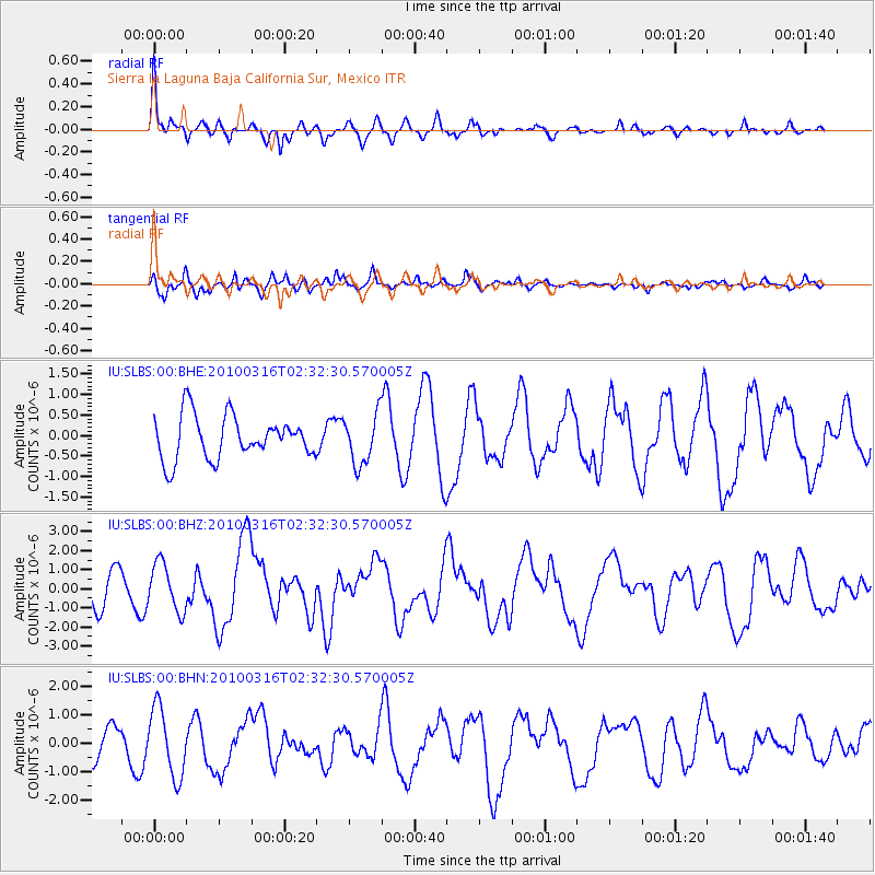
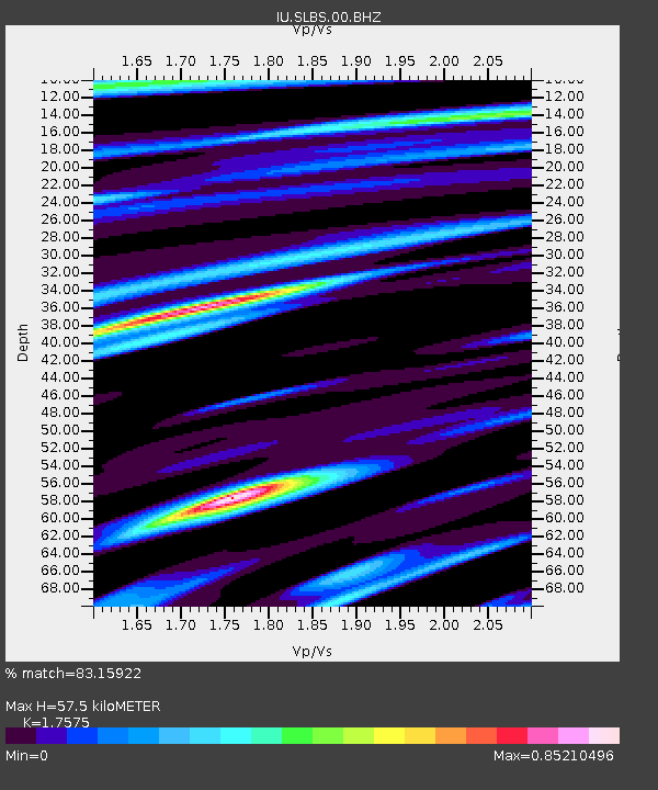
Earthquake location: Near Coast Of Central Chile
Earthquake latitude/longitude: -36.2/-73.3
Earthquake time(UTC): 2010/03/16 (075) 02:21:57 GMT
Earthquake Depth: 18 km
Earthquake Magnitude: 6.0 MB, 6.7 MS, 6.7 MW, 6.6 MW
Earthquake Catalog/Contributor: WHDF/NEIC
Network: IU Global Seismograph Network (GSN - IRIS/USGS)
Station: SLBS Sierra la Laguna Baja California Sur, Mexico
Lat/Lon: 23.69 N/109.94 W
Elevation: 825 m
Distance: 68.9 deg
Az: 324.059 deg
Baz: 148.818 deg
Ray Param: 0.05596561
Estimated Moho Depth: 57.5 km
Estimated Crust Vp/Vs: 1.76
Assumed Crust Vp: 6.183 km/s
Estimated Crust Vs: 3.518 km/s
Estimated Crust Poisson's Ratio: 0.26
Radial Match: 83.15922 %
Radial Bump: 382
Transverse Match: 66.175255 %
Transverse Bump: 400
SOD ConfigId: 308276
Insert Time: 2010-06-22 20:05:34.572 +0000
GWidth: 2.5
Max Bumps: 400
Tol: 0.001

Signal To Noise

ChannelStoNSTALTA
IU:SLBS:00:BHZ:20100316T02:32:30.570005Z1.05735361.2521616E-61.1842411E-6
IU:SLBS:00:BHN:20100316T02:32:30.570005Z3.27603341.1973314E-63.6548204E-7
IU:SLBS:00:BHE:20100316T02:32:30.570005Z1.15056316.044999E-75.2539485E-7
Arrivals
Ps7.3 SECOND
PpPs25 SECOND
PsPs/PpSs32 SECOND