You are here: Home > Network List > US - United States National Seismic Network Stations List
> Station MNTX Cornudas Mountains, Texas, USA > Earthquake Result Viewer
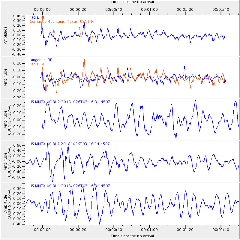
MNTX Cornudas Mountains, Texas, USA - Earthquake Result Viewer
*The percent match for this event was below the threshold and hence no stack was calculated.
| Earthquake location: |
Hokkaido, Japan Region |
| Earthquake latitude/longitude: |
44.5/145.4 |
| Earthquake time(UTC): |
2018/10/26 (299) 03:04:53 GMT |
| Earthquake Depth: |
10 km |
| Earthquake Magnitude: |
5.6 Mww |
| Earthquake Catalog/Contributor: |
NEIC PDE/us |
|
| Network: |
US United States National Seismic Network |
| Station: |
MNTX Cornudas Mountains, Texas, USA |
| Lat/Lon: |
31.70 N/105.38 W |
| Elevation: |
404 m |
|
| Distance: |
80.5 deg |
| Az: |
54.693 deg |
| Baz: |
316.791 deg |
| Ray Param: |
$rayparam |
*The percent match for this event was below the threshold and hence was not used in the summary stack. |
|
| Radial Match: |
62.91896 % |
| Radial Bump: |
400 |
| Transverse Match: |
57.525726 % |
| Transverse Bump: |
400 |
| SOD ConfigId: |
3103472 |
| Insert Time: |
2018-11-09 17:06:31.048 +0000 |
| GWidth: |
2.5 |
| Max Bumps: |
400 |
| Tol: |
0.001 |
|
Signal To Noise
| Channel | StoN | STA | LTA |
| US:MNTX:00:BHZ:20181026T03:16:34.450Z | 2.9661505 | 3.07358E-7 | 1.03621836E-7 |
| US:MNTX:00:BH1:20181026T03:16:34.450Z | 1.3849086 | 1.03444336E-7 | 7.4693986E-8 |
| US:MNTX:00:BH2:20181026T03:16:34.450Z | 0.73454994 | 6.894033E-8 | 9.3853835E-8 |
| Arrivals |
| Ps | |
| PpPs | |
| PsPs/PpSs | |


