You are here: Home > Network List > IU - Global Seismograph Network (GSN - IRIS/USGS) Stations List
> Station RSSD Black Hills, South Dakota, USA > Earthquake Result Viewer
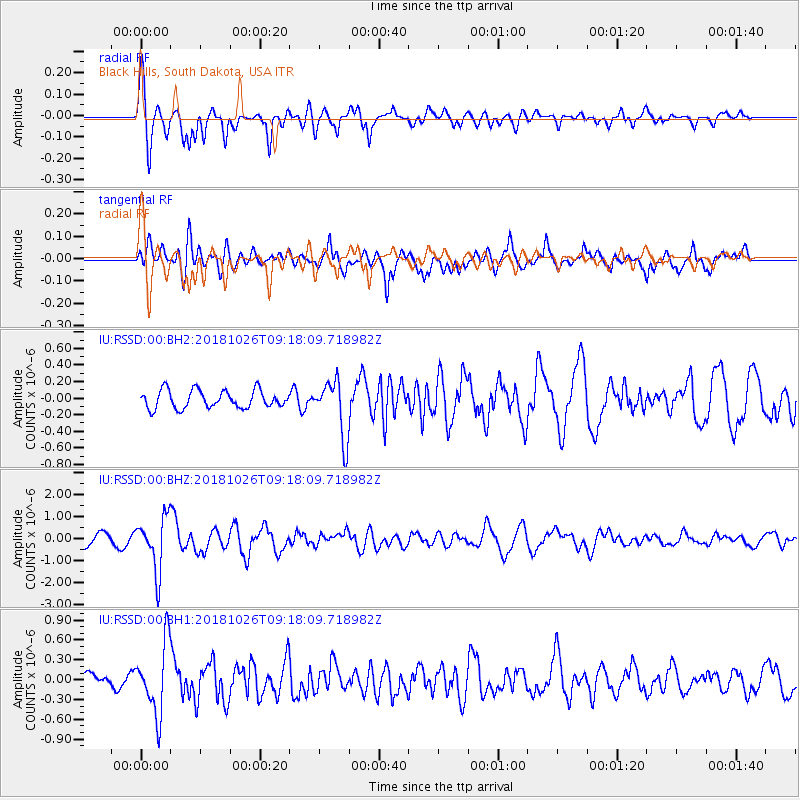
RSSD Black Hills, South Dakota, USA - Earthquake Result Viewer
*The percent match for this event was below the threshold and hence no stack was calculated.
| Earthquake location: |
Mariana Islands Region |
| Earthquake latitude/longitude: |
17.4/147.9 |
| Earthquake time(UTC): |
2018/10/26 (299) 09:05:39 GMT |
| Earthquake Depth: |
10 km |
| Earthquake Magnitude: |
5.7 mww |
| Earthquake Catalog/Contributor: |
NEIC PDE/us |
|
| Network: |
IU Global Seismograph Network (GSN - IRIS/USGS) |
| Station: |
RSSD Black Hills, South Dakota, USA |
| Lat/Lon: |
44.12 N/104.04 W |
| Elevation: |
2090 m |
|
| Distance: |
90.4 deg |
| Az: |
43.207 deg |
| Baz: |
294.803 deg |
| Ray Param: |
$rayparam |
*The percent match for this event was below the threshold and hence was not used in the summary stack. |
|
| Radial Match: |
76.1813 % |
| Radial Bump: |
400 |
| Transverse Match: |
74.366745 % |
| Transverse Bump: |
400 |
| SOD ConfigId: |
3103472 |
| Insert Time: |
2018-11-09 17:10:23.242 +0000 |
| GWidth: |
2.5 |
| Max Bumps: |
400 |
| Tol: |
0.001 |
|
Signal To Noise
| Channel | StoN | STA | LTA |
| IU:RSSD:00:BHZ:20181026T09:18:09.718982Z | 4.2037773 | 1.2146206E-6 | 2.8893552E-7 |
| IU:RSSD:00:BH1:20181026T09:18:09.718982Z | 3.274248 | 5.2998723E-7 | 1.6186533E-7 |
| IU:RSSD:00:BH2:20181026T09:18:09.718982Z | 3.2124684 | 3.4319967E-7 | 1.0683363E-7 |
| Arrivals |
| Ps | |
| PpPs | |
| PsPs/PpSs | |


