You are here: Home > Network List > IW - Intermountain West Stations List
> Station DLMT Dillon, Montana, USA > Earthquake Result Viewer
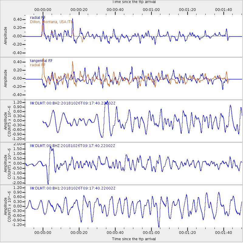
DLMT Dillon, Montana, USA - Earthquake Result Viewer
*The percent match for this event was below the threshold and hence no stack was calculated.
| Earthquake location: |
Mariana Islands Region |
| Earthquake latitude/longitude: |
17.4/147.9 |
| Earthquake time(UTC): |
2018/10/26 (299) 09:05:39 GMT |
| Earthquake Depth: |
10 km |
| Earthquake Magnitude: |
5.7 mww |
| Earthquake Catalog/Contributor: |
NEIC PDE/us |
|
| Network: |
IW Intermountain West |
| Station: |
DLMT Dillon, Montana, USA |
| Lat/Lon: |
45.36 N/112.60 W |
| Elevation: |
1569 m |
|
| Distance: |
84.3 deg |
| Az: |
44.324 deg |
| Baz: |
288.843 deg |
| Ray Param: |
$rayparam |
*The percent match for this event was below the threshold and hence was not used in the summary stack. |
|
| Radial Match: |
60.609406 % |
| Radial Bump: |
372 |
| Transverse Match: |
64.39213 % |
| Transverse Bump: |
336 |
| SOD ConfigId: |
3103472 |
| Insert Time: |
2018-11-09 17:10:33.122 +0000 |
| GWidth: |
2.5 |
| Max Bumps: |
400 |
| Tol: |
0.001 |
|
Signal To Noise
| Channel | StoN | STA | LTA |
| IW:DLMT:00:BHZ:20181026T09:17:40.22002Z | 3.0495574 | 1.0294774E-6 | 3.3758255E-7 |
| IW:DLMT:00:BH1:20181026T09:17:40.22002Z | 0.83393633 | 3.1451188E-7 | 3.7714133E-7 |
| IW:DLMT:00:BH2:20181026T09:17:40.22002Z | 2.317796 | 7.247005E-7 | 3.1266794E-7 |
| Arrivals |
| Ps | |
| PpPs | |
| PsPs/PpSs | |


